Copper Canyon Railway
David Broad / Wikimedia Commons · CC BY 3.0
- Distance~673 km
- DurationChepe Express · ~9 hours
- Best seasonAutumn–spring
Introduction
Mexico once had a proud network of passenger trains. Almost all of them are gone — except the greatest of the lot. The Chihuahua al Pacífico, known to everyone simply as El Chepe, still runs, and it remains one of the most spectacular railway journeys in the Americas.
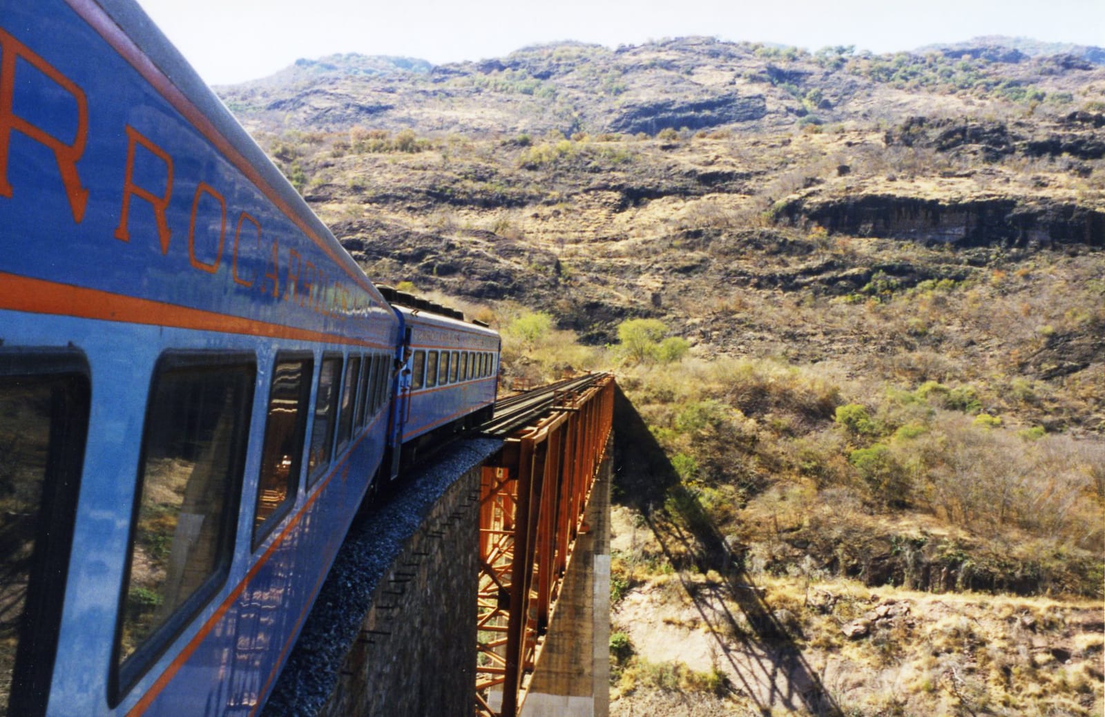
In some 673 kilometres it climbs from the Pacific port of Los Mochis, over the Sierra Madre Occidental, and down to the high desert city of Chihuahua — and in between it threads the Copper Canyon, the Barrancas del Cobre, a system of six great canyons carved into the Sierra Tarahumara. To do it, the line crosses 37 bridges and burrows through 86 tunnels, looping back on itself to gain height in a feat of engineering that took the better part of a century and was only finished in 1961.
This is also the homeland of the Rarámuri — the Tarahumara — the indigenous people famous the world over as endurance runners. Ride the Chepe slowly, breaking the trip along the way, and you get canyon, culture and one of the last great train adventures in North America.
The Journey
The classic journey runs inland from the Pacific, gaining a couple of thousand metres of height as it goes.
It begins at Los Mochis, near the coast in Sinaloa, and after the flat farmland comes the first real stop: El Fuerte, a pretty colonial town — a designated Pueblo Mágico — and the place most travellers actually join the train to skip the dull opening miles.
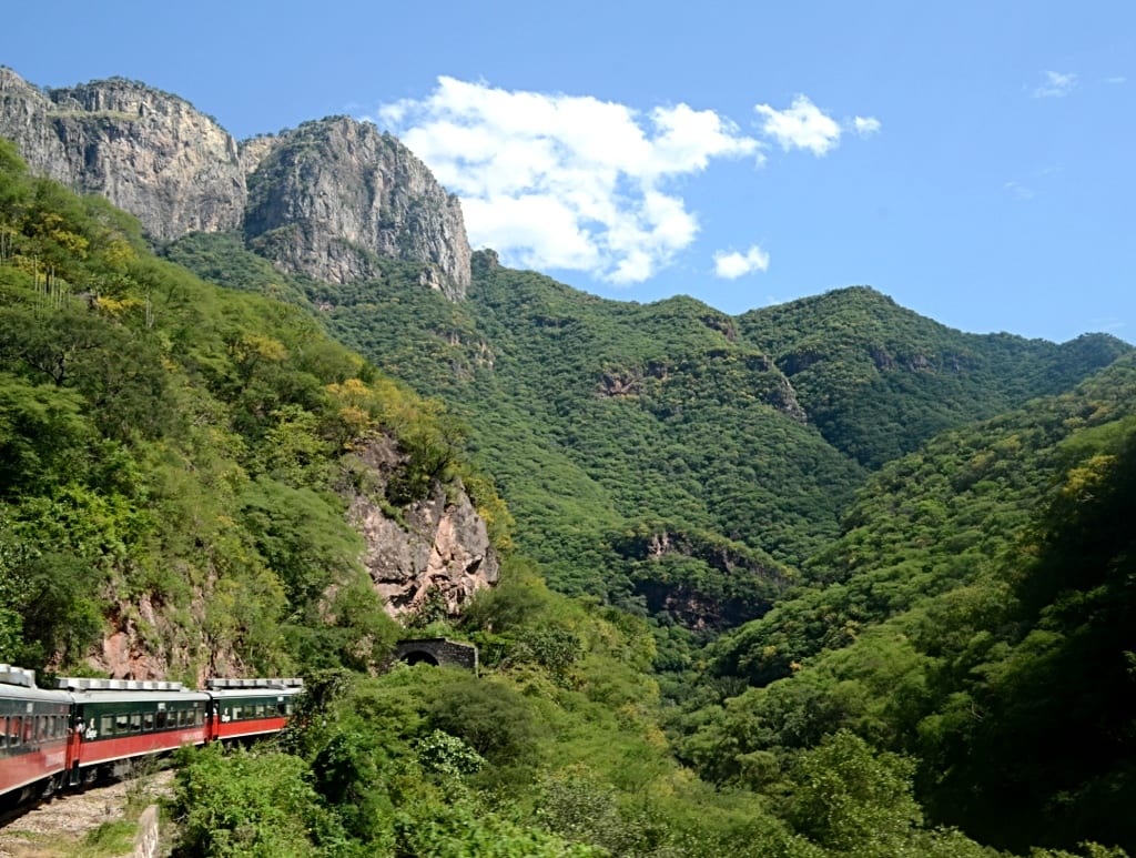
Beyond El Fuerte the mountains begin, and the railway starts to show off. It follows river gorges, crosses the Río Fuerte on a long bridge, and climbs through tunnel after tunnel, curling through great loops to gain height. This is the wild, forested heart of the line — subtropical canyon country, green and steep after the summer rains.
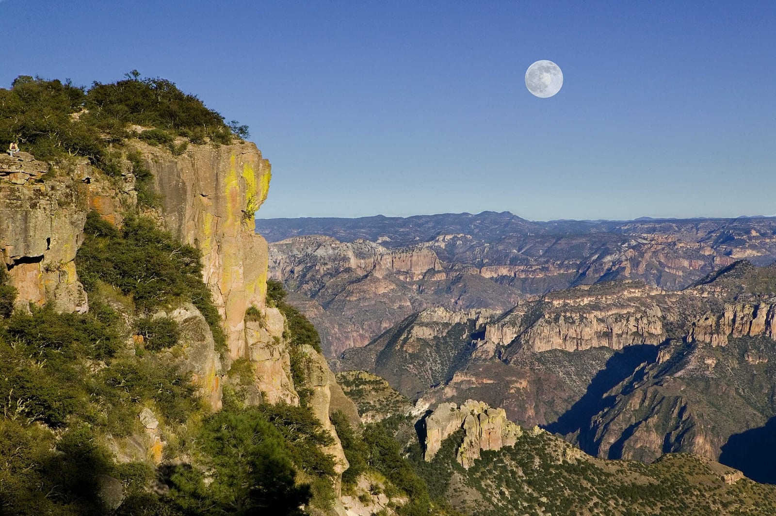
Near Bahuichivo (the stop for the villages of Cerocahui and the mile-deep Urique canyon) the country opens out, and then comes the moment everyone waits for: Divisadero. Here the train stops for a quarter of an hour right on the rim of the Copper Canyon, so that everyone can walk to the edge and look out over the vast folded sierra — and buy a gordita from the Rarámuri women at the lookout.
From Divisadero the line runs up onto the pine-clad highlands to Creel, the friendly logging-and-tourism town that is the base for exploring the canyons on foot. The tourist Chepe Express turns around near here; the local Chepe Regional carries on across the high plains to journey's end at the city of Chihuahua.
Along the route
Comisión Mexicana de Filmaciones / Wikimedia Commons · CC BY-SA 2.0Barrancas del Cobre
At Divisadero the train stops right on the rim of the Copper Canyon — a system of six great canyons far larger than any single view can hold. The trains pause here on purpose, so nobody misses it.David Broad / Wikimedia Commons · CC BY 3.037 bridges, 86 tunnels
The line took the best part of a century to build, and it shows: to climb the Sierra Madre it crosses 37 bridges and bores through 86 tunnels, curling back on itself in great loops to gain height. The engineering is half the spectacle.Justin Vidamo / Wikimedia Commons · CC BY 2.0The green Sierra climb
Between the Pacific lowlands and the pine highlands the train winds through steep, forested canyon country — subtropical and, after the summer rains, impossibly green — diving into tunnels and out onto ledges above the rivers.A bit of history
Culture & experiences along the way
Robert Ferréol / Wikimedia Commons · CC BY-SA 4.0Ride the Chepe Express
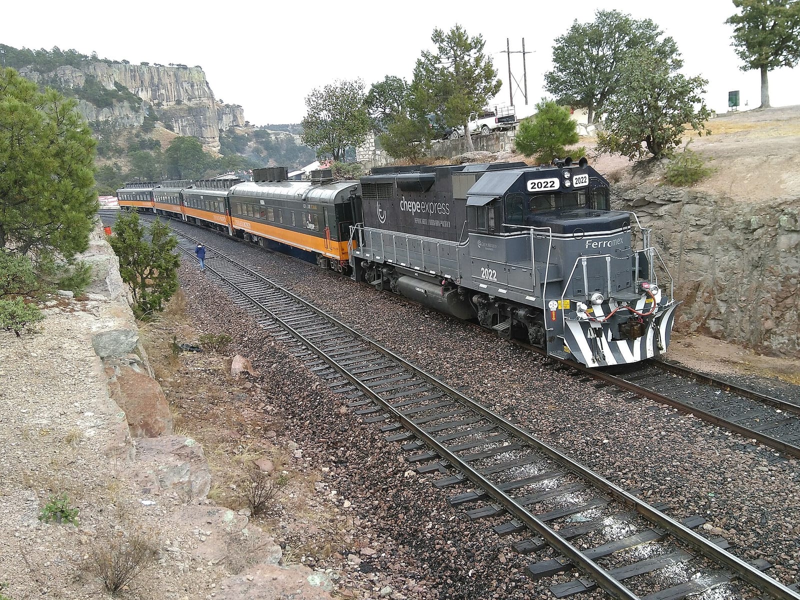
The modern tourist train has glass-roofed carriages, a dining car, a bar and an open-air terrace car built for watching the canyon roll by. It runs from Los Mochis up to Creel via the great viewpoint at Divisadero.Ane Martins / Wikimedia Commons · CC BY-SA 4.0Meet the Rarámuri
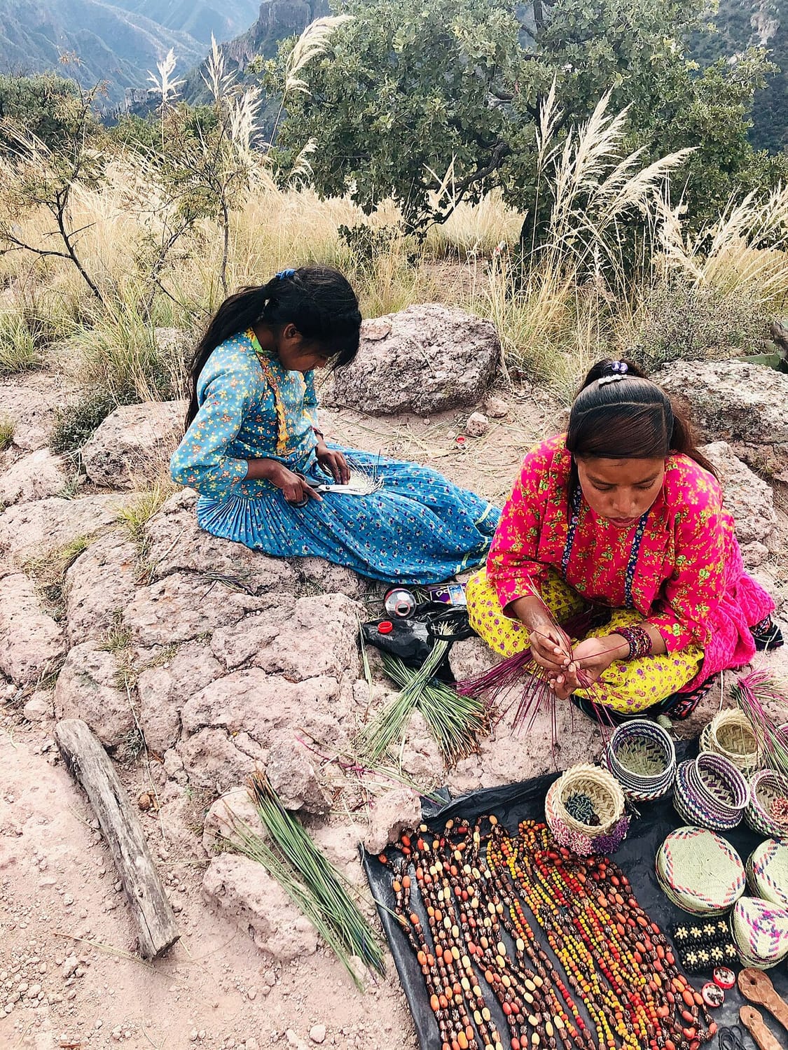
The canyon country is the homeland of the Rarámuri (Tarahumara), the indigenous people famous the world over as endurance runners. You'll meet them at Divisadero and along the line, selling beautifully woven baskets and crafts.Hansm / Wikimedia Commons · CC BY-SA 3.0Break the journey
The Chepe is best taken slowly. Step off at the colonial Pueblo Mágico of El Fuerte, at Divisadero for the canyon and its cable car and zip-line, and at the highland town of Creel — the trains run often enough to hop between them over several days.Timetables
There are two Chepe trains, and picking the right one matters. The premium Chepe Express runs the scenic core between Los Mochis and Creel (with a first-class extension on to Chihuahua on some days); the everyday Chepe Regional covers the whole line.
Real Chepe Express times (2026 — confirm before travelling):
| Direction | Days | Depart | Arrive |
|---|---|---|---|
| Los Mochis → Creel | Mon, Thu, Sat | 07:00 | ~17:40 |
| Creel → Los Mochis | Tue, Fri, Sun | 08:00 | ~16:40 |
That's about 9½–10 hours for the full scenic run, through El Fuerte, Bahuichivo and Divisadero (the canyon-rim stop). The Chepe Regional runs the longer Los Mochis ⇄ Chihuahua line more cheaply and more basically.
Good to know:
- ⚠️ Mind the time zone. Sinaloa (Los Mochis) is one hour behind Chihuahua — an easy way to miss a train.
- Don't do it in one go. Hop off at El Fuerte, Divisadero and Creel and rejoin a later train — that, not the through-run, is the classic Copper Canyon trip.
- Join at El Fuerte to skip the flat, dull Los Mochis–El Fuerte stretch.
- Book the Express ahead in the high seasons (spring and autumn); the Regional is easier to get.
Times as of the 2026 timetable. Confirm current schedules with the operator — see the Tickets section below.
Tickets
Tickets are booked directly with Chepe (the Ferromex passenger brand) on chepe.mx, and the first decision is which train — and, on the Express, which class.
- Chepe Express — the tourist train, in three grades: Tourist, Executive and First class, all sharing the dining car, bar and open-air terrace car, with the higher grades adding more space and lounge access. This is the one to book for the scenery.
- Chepe Regional — the local service over the full line to Chihuahua, with simpler seating and a much lower fare. Fewer comforts, but a genuine slice of everyday Mexican rail travel.
A few pointers:
- Fares are seasonal and change, so we point you to Chepe for a live price rather than quote a figure that will date.
- Book ahead in high season (autumn and spring, and around Mexican holidays) — the Express and the popular Divisadero legs fill up.
- Buy segment by segment. Because you'll want to break the trip, book each leg (Los Mochis–El Fuerte, El Fuerte–Divisadero, Divisadero–Creel) rather than one through ticket.
- Bring pesos. The canyon towns and the Rarámuri stalls run on cash.
Book your tickets
Chepe Express
The tourist train · Los Mochis–Creel
The modern Chepe Express — glass-roofed cars, a dining car, a bar and an open terrace car — running the scenic core of the line between Los Mochis and Creel via Divisadero, with Tourist, Executive and First-class cabins.
Book Tickets (opens in a new tab, on Chepe (Ferromex))via Chepe (Ferromex)Chepe Regional
The local train · full route
The everyday Chepe Regional runs the whole line between Los Mochis and Chihuahua, stopping on request for local passengers. Slower, cheaper and more of an adventure — the way the canyon communities actually travel.
Book Tickets (opens in a new tab, on Chepe (Ferromex))via Chepe (Ferromex)Rail Passes
No rail pass covers the Copper Canyon. Interrail and Eurail are European schemes, and Mexico is not among the 33 countries in Interrail's list of covered railway companies (opens in a new tab). Chepe sells the Express and the Regional as tickets for each journey.
Checked October 2026 against Interrail's list of covered railway companies (opens in a new tab).
Places to Visit
The whole point of the Chepe is to get off it. Bahuichivo is the stop for Cerocahui, a tiny mission village in a walnut valley, and for the road that drops from there to Urique; Creel is the base for almost everything on the highland side.
Two practical notes. Chihuahua is one of the Mexican states for which the US government advises reconsidering travel, and while the railway towns themselves are used to visitors, the sensible approach in the sierra is to walk and drive with a local guide rather than strike out alone. And the deep-canyon towns are a long way down: Batopilas sits some 1,800 metres below Creel, five hours away by bus, which makes it an overnight trip rather than a day out.
 Hansm / Wikimedia Commons · CC BY-SA 3.0 · cropped
El Fuerte
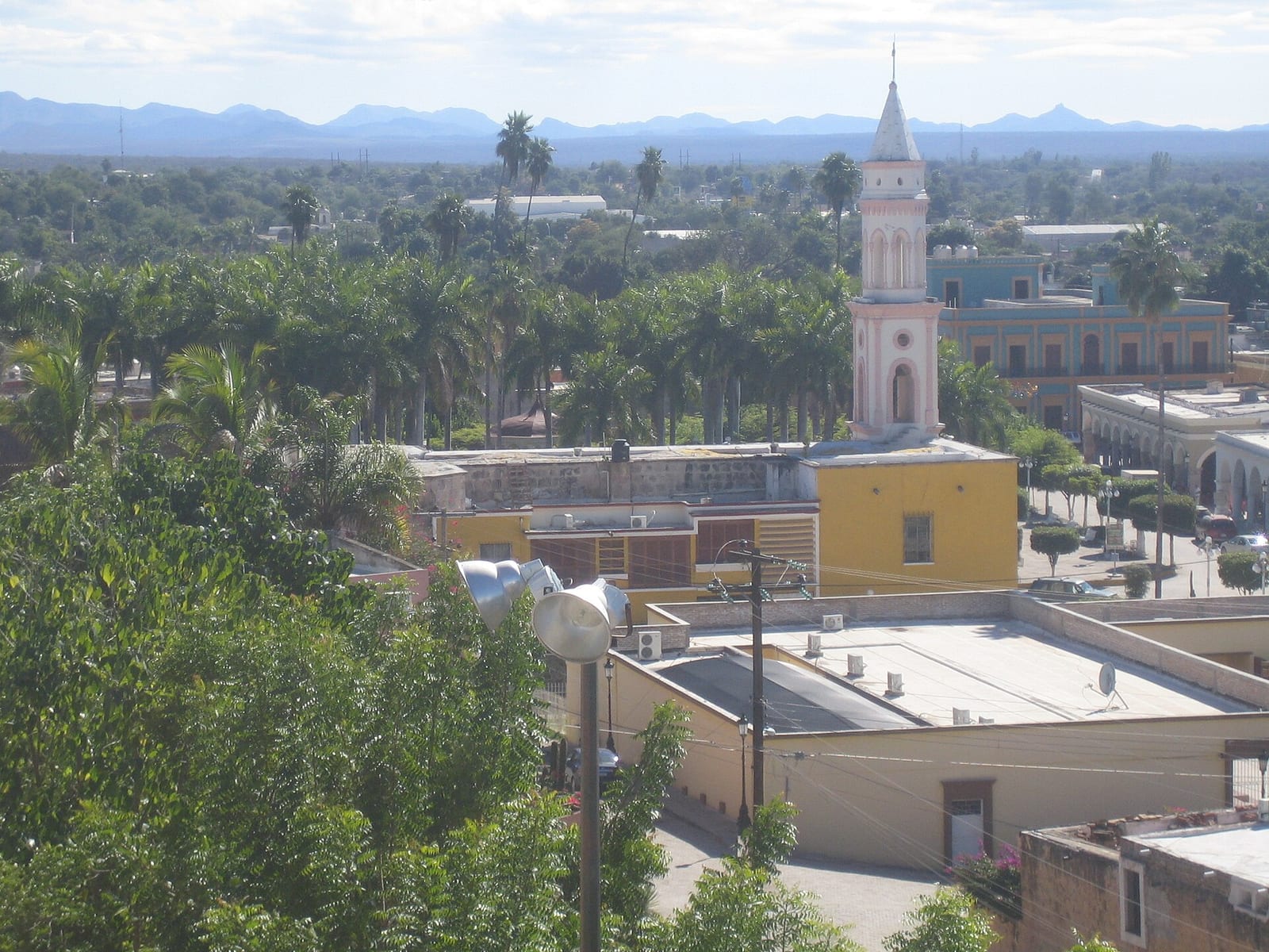
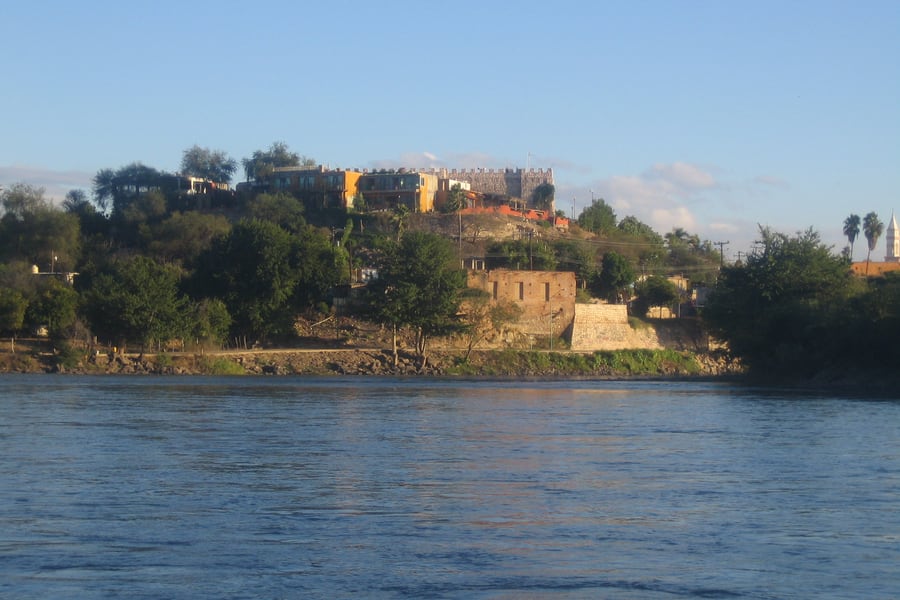
Founded in 1563 by Francisco de Ibarra and walled in 1610 against Zuaque and Tehueco raids, El Fuerte has been a Pueblo Mágico since 2009 — cobbles, arcades and a shaded plaza a short hop from the Chepe's western terminus. One caveat about the castle on the bluff above the river: it is a replica, put up in 2001 on the hill where the presidio is thought to have stood, and it houses the town museum rather than any original fabric.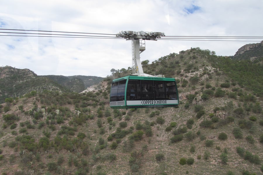 BetoCG / Wikimedia Commons · CC BY 2.0 · cropped
Divisadero adventure park
The train pauses at Divisadero for the view; the park next door is what you stay a night for. A cable car crosses the gorge to a pinnacle on the far side, and the ZipRider runs 2,545 m in a single span, more than 400 m above the canyon floor and quick enough to touch 135 km/h. Both were out of action for a spell and the teleférico reopened in August 2025 after a new six-kilometre haul cable was fitted.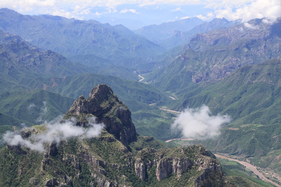 panza.rayada / Wikimedia Commons · CC BY-SA 3.0 · cropped
Urique
Get off at Bahuichivo and take the road down. Urique lies at the bottom of one of the six canyons, and the descent to it is the single most alarming and most spectacular drive on the whole route — a switchback thread cut into the wall, with the river a silver line far below for most of the way. The town itself is small, hot and subtropical, a different climate entirely from the pine forest you left an hour earlier.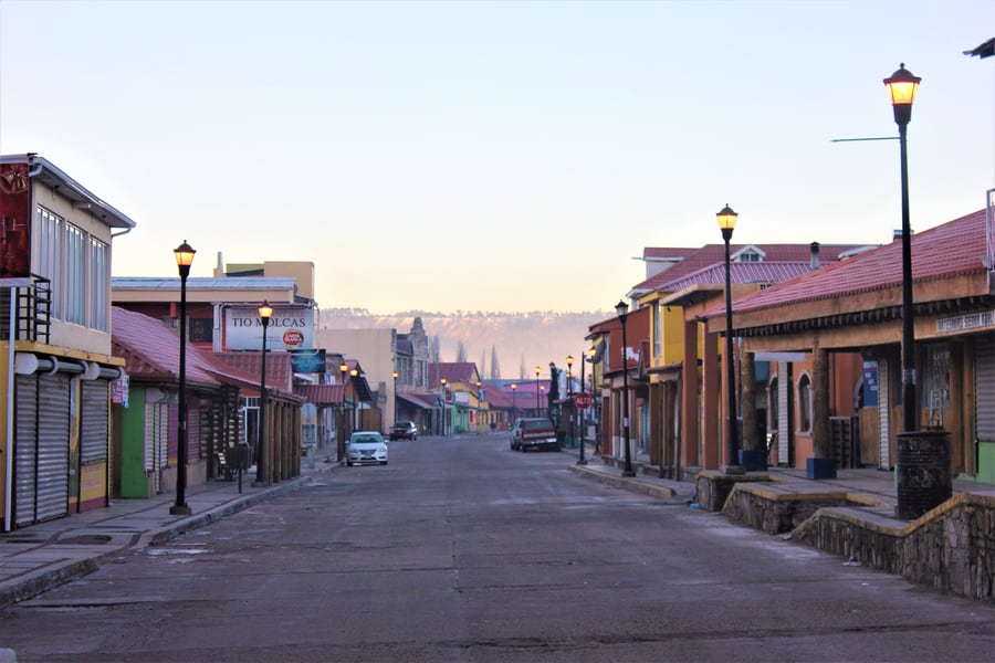 Charlie Marchant / Wikimedia Commons · CC BY 2.0 · cropped
Creel
The base for the highland half, and it exists because of this railway: founded on 26 May 1907 as a depot and named for Enrique Creel, then governor of Chihuahua. It sits in the pines at 2,350 m, which is why the nights are cold even in summer, and it is a town of perhaps five thousand people that lives almost entirely on visitors heading out to the lakes, the waterfalls and the Rarámuri settlements around it.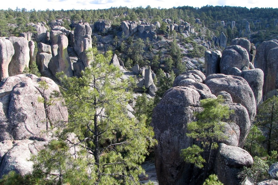 Carlos Adampol Galindo / Wikimedia Commons · CC BY-SA 2.0 · cropped
Valle de los Monjes
Fifteen kilometres from Creel, a shallow basin is filled with rock columns standing among the pines, the tallest around 30 m. Spanish called them monks, for the hooded look of the pillars; the older Rarámuri name, Bisabírachi, is a good deal less decorous about what they resemble. Two neighbouring valleys do the same trick as mushrooms and as frogs. All three sit on the ejido of San Ignacio de Arareko, which runs the access.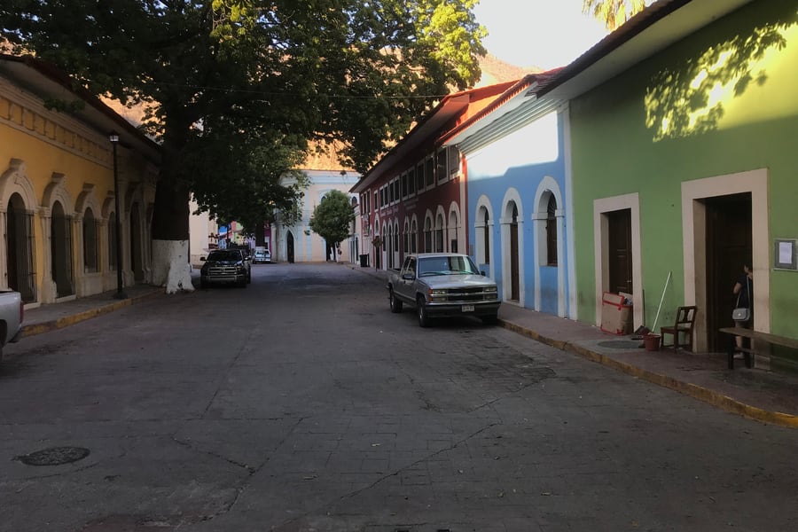 Crook1 / Wikimedia Commons · CC BY-SA 4.0 · cropped
Batopilas
Founded on a mine claim in 1708 and rich enough by the 1740s to be shipping silver out by mule train, Batopilas boomed again after the American Alexander Shepherd bought the workings in 1879 — by 1887 it held over 6,500 people, and his hydro plant made it the second town in Mexico after the capital to have electric light. It is a Pueblo Mágico now, at 578 m, and getting there is still most of the adventure.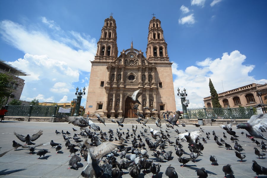 Comisión Mexicana de Filmaciones / Wikimedia Commons · CC BY-SA 2.0 · cropped
Chihuahua
The line ends in a handsome high-desert city with a long revolutionary memory: Miguel Hidalgo was shot in the Government Palace courtyard on 30 July 1811, and Pancho Villa's fifty-room house is a museum because his widow, Luz Corral, kept it as one until she died in 1981. On the Plaza de Armas stands the cathedral, begun 21 June 1725 and unfinished until 1792 — its towers were started in 1758, the bells cast back in 1730.Where to Sleep
Because the Copper Canyon trip is best broken into stages, where you sleep is part of the planning — and one night on the canyon rim is close to essential.
- El Fuerte — characterful colonial hotels around the plaza, several in restored historic mansions; a gentle, warm place to spend the first or last night.
- Divisadero — a handful of rim-edge hotels perched right on the canyon, with balconies over the drop. Pricey and much in demand, but waking to that view is the memory people come home with — book well ahead.
- Creel — the widest choice at the highland end, from simple hostels to comfortable lodges, and the best base for canyon day trips.
- Cerocahui — quiet mission-village inns for those detouring down toward Urique.
The canyon is busiest in the autumn and spring shoulder seasons and around Mexican holidays; reserve the Divisadero rim hotels as far ahead as you can, as there are only a few rooms with that view.
Questions or corrections
Planning this trip and stuck on something, or spotted a time, fare or detail that has changed? Send us a message about Copper Canyon Railway. We read every one, and we update this page when something has changed.