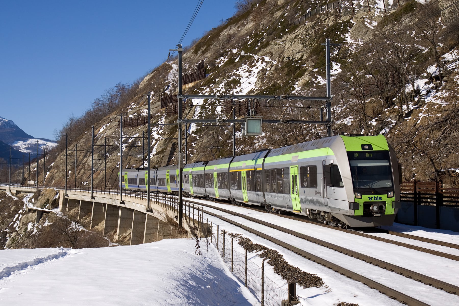
Lötschberg Mountain Line
Kabelleger / David Gubler / Wikimedia Commons · Public domain · 2009 · cropped
- Distance74 km
- Duration1 hr 10 min
- Best seasonHourly all year · 17 trains each way
Introduction
Eleven minutes separate Kandersteg from Goppenstein, and somewhere in the middle of them, under the Balmhorn, the train touches 1,240 metres above the sea. It is the highest point reached by any standard-gauge railway in Switzerland, it is the moment the whole climb has been building towards, and it is where the canton changes from Bern to Valais. Nobody has ever seen it. It sits inside the Lötschberg Summit Tunnel, fourteen and a half kilometres of darkness driven between 1907 and 1913, and the eight minutes it takes to pass through are eight minutes of nothing at all. The mountain the railway is named after is the one part of the journey the railway will not show you.
What it shows you instead is everything on either side. North of the tunnel the line climbs the Kander valley on a masonry viaduct, doubles back on itself in an open loop above Blausee and then turns underground through a spiral to gain the last of its height into Kandersteg. South of it the line comes out 450 metres above the floor of the Rhône valley and stays there, running east along the mountainside on a ledge of bridges, galleries and tunnels all the way down to Brig. Since 2007 it has had that ledge nearly to itself: the Lötschberg Base Tunnel took the InterCitys and most of the freight into the mountain at Frutigen, and what is left on top is an hourly BLS RegioExpress that costs no more than any other regional train and takes thirty-five minutes longer than the way underneath.
The Journey
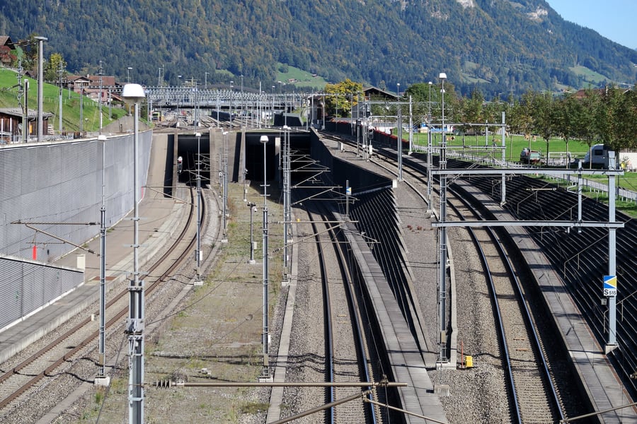
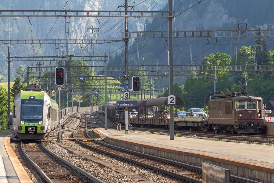
The line begins at Spiez, on a shelf above Lake Thun at 628 metres, and the first quarter of an hour is only a run-up. The train climbs steadily at fifteen per mille through the Hondrich tunnel into the Kander valley, calls at Mülenen — where the Niesen funicular starts from the next building along — and again at Reichenbach im Kandertal, then crosses the Kander and runs into the wider Frutig valley. Frutigen, at 779 metres and thirteen and a half kilometres from Spiez, is where the two Lötschbergs part company. Immediately south of the platforms the Lötschberg Base Tunnel opens in the hillside, and the InterCitys to Brig and Milan and most of the freight dive into it and do not see daylight again until Raron, on the far side of the Alps. The RegioExpress stays outside.
The north ramp
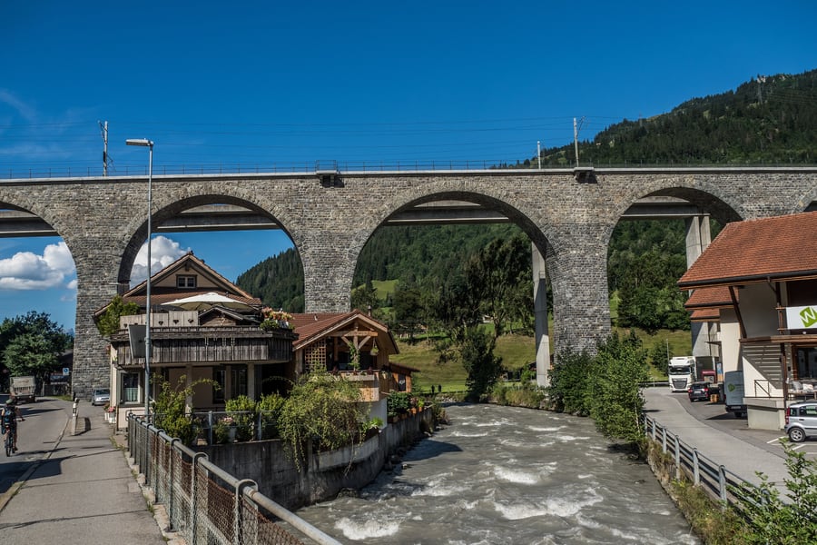
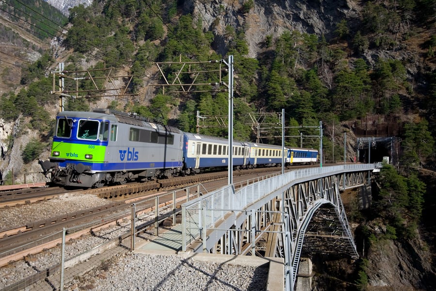
The mountain line proper starts there, at twenty-seven per mille, and the first thing it does is the most photographed thing on the route: a left-hand curve past the ruined Tellenburg onto the Kander viaduct, two bridges side by side about twenty-eight metres above the river. The older of them is the original masonry arch of 1913, 265 metres long on ten spans of twenty metres and one of twenty-five; the concrete beam viaduct fifteen metres to the north carries the second track and was built in 1981.
After that the railway sets about the problem of gaining 400 metres in a valley that will not give it the room. It climbs the right-hand side of the Kandertal, crosses to the other side and swings back through the open Blausee curve to reach the old station at Blausee-Mitholz, then runs back down the hillside in the opposite direction, north to south becoming south to north, over a succession of short viaducts. At the top of that stretch it disappears into the 1,655-metre Kehrtunnel, turns a half-circle inside the mountain and comes out pointing south again — the double loop that made the line famous among railway engineers, one turn in the open and one in the dark. Kandersteg, at 1,176 metres, arrives on a level stretch of 842 metres. Before the railway came, the village could be reached from Valais only on foot, over the Gemmi or the Lötschen pass.
Eight minutes
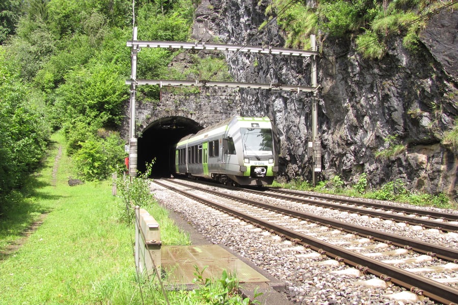
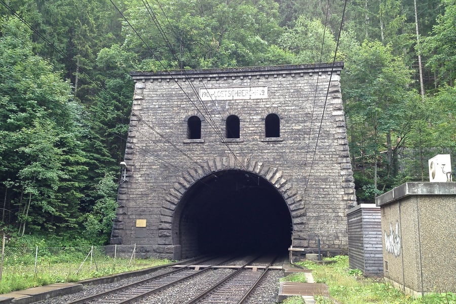
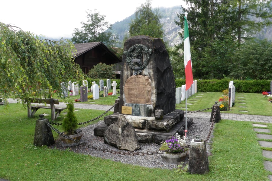
Two kilometres beyond the station is the north portal, a stone arch with the word LÖTSCHBERG cut into it. The tunnel was designed to be 13,744 metres long and straight. On 24 July 1908 the heading under the Gasterntal broke into water-bearing glacial debris; the tunnel flooded, twenty-five men on that shift were killed and three survived, and the drive was abandoned and restarted on a curve that crosses under the Kander somewhere else entirely. The tunnel that opened was 14.6 kilometres long, and the bend in it is the reason. A monument in the cemetery at Kandersteg carries the names.
The crossing takes about eight minutes. The maintenance man who walks it needs roughly seven and a half hours. Halfway through, unmarked and invisible, the line reaches 1,240 metres and passes from the canton of Bern into Valais, and when the windows fill again it is a different country: dry, south-facing, terraced, and speaking a Valaisan German of its own.
The south ramp
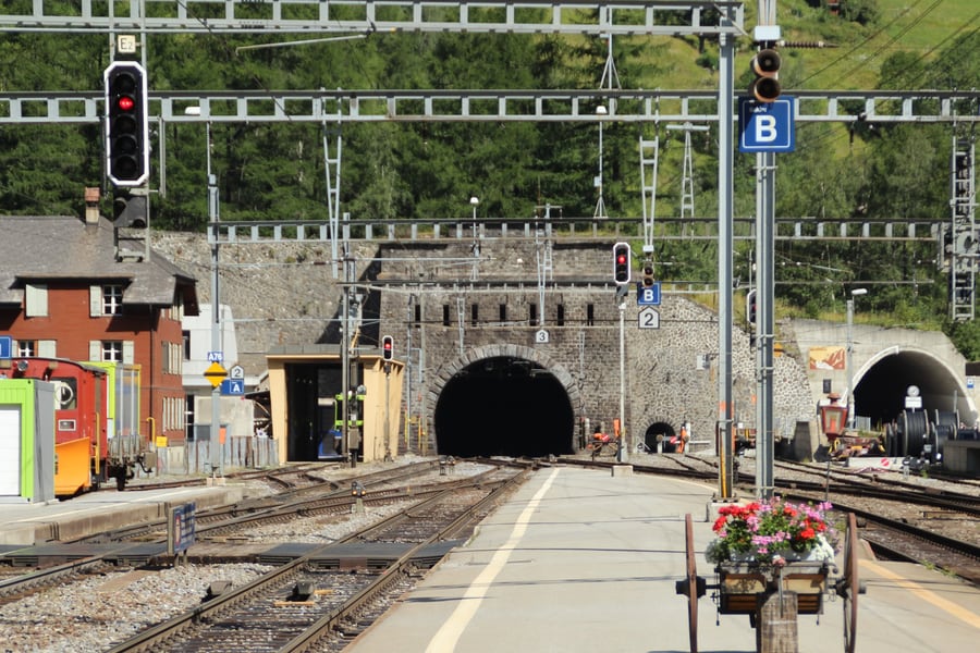
Goppenstein is a station wedged into the Lonza gorge, with the car-shuttle ramps built out over the river because there is nowhere else to put them. It is the railhead for the Lötschental, the side valley climbing east behind it — a valley that lost its head village on 28 May 2025, when the Birch glacier came down and buried Blatten. The road up from Goppenstein as far as Wiler reopened nine days later; beyond that the valley floor is gone.
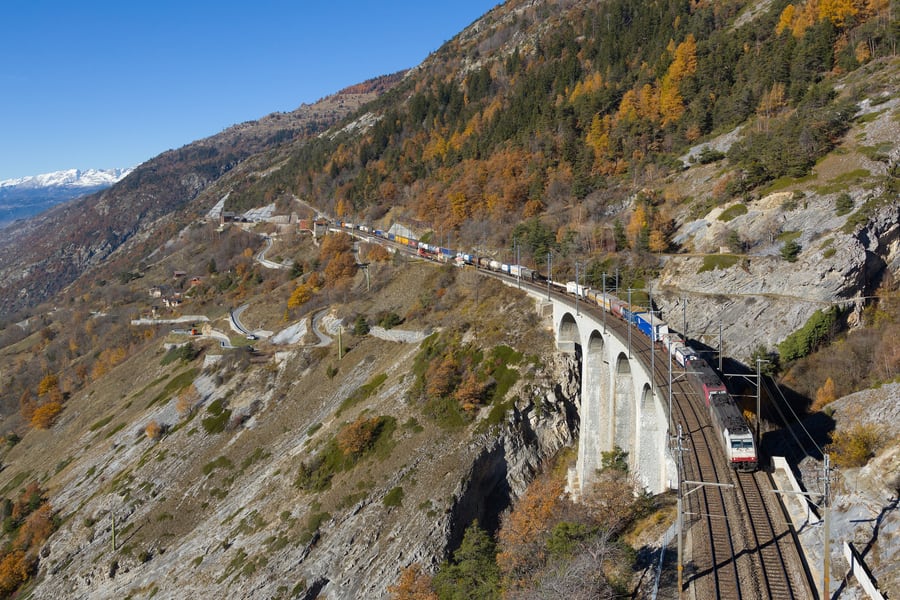
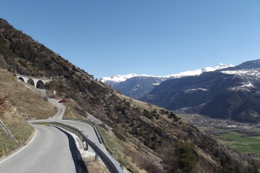
From Goppenstein the line falls at twenty-seven per mille along the eastern wall of the gorge, crosses the Lonza viaduct, and threads a run of avalanche galleries and tunnels before the Hohtenntunnel turns it through ninety degrees to the east. It emerges onto the north flank of the Rhône valley with the floor 450 metres below, and it holds that height. Hohtenn station stands at 1,078 metres, three kilometres above the village it is named for, and it is where the BLS's south-ramp path begins — a high-level walk that follows the railway most of the way to Brig, using long stretches of the formation of the 750-millimetre construction railway, tunnels included, and crossing the Suonen, the open irrigation channels the Valais has used for six centuries.
Then the bridges come one after another: the 123-metre Luogelkin viaduct, the iron arch over the Bietschtal between two tunnels, the Baltschieder viaduct. Ausserberg sits at 932 metres among vines; Eggerberg is a halt that begins inside a 792-metre tunnel, and from just below it you can see Visp on the valley floor and, opposite, the mouth of the Mattertal running up towards Zermatt. Lalden follows, then a long descent on retaining viaducts to the Rhône bridge and into Brig at 678 metres — the same altitude, near enough, at which the journey started.
What runs on it
The class that belongs to this line is the RABe 535, a four-car low-floor unit the BLS calls the Lötschberger — and it is called that, the operator says, because it was bought expressly to work Bern to Brig over the mountain. Twenty-five entered service between 2009 and 2013. Each is 62.7 metres long, weighs 105 tonnes, is good for 160 km/h, and seats 142, with a step-free entrance at every door and six or twelve bicycle spaces depending on the batch; up to four can run coupled together. Several carry the names of places on the line — 123 is Ausserberg, 124 is Eggerberg, 104 is Naters — christened at the stations themselves.
They are no longer confined to it. The BLS now runs them across its whole network, and the RE1 is just as likely to turn up as a MIKA, the RABe 528: 105 metres, single-deck, in service since 2021, with a bistro area, sockets at practically every seat and a good deal more window. Meanwhile the Lötschberger fleet is being refitted at the BLS works at Bönigen, mid-2024 to 2027, at about CHF 17 million, so that it can run until 2037 — LED lighting, carbon-dioxide sensors on the ventilation, two sockets per bay of four. One detail of that refit is worth knowing in advance: the exterior is being brought into line with the MIKA design, and while the name stays, the Lötschberger script is coming off the side of the train.
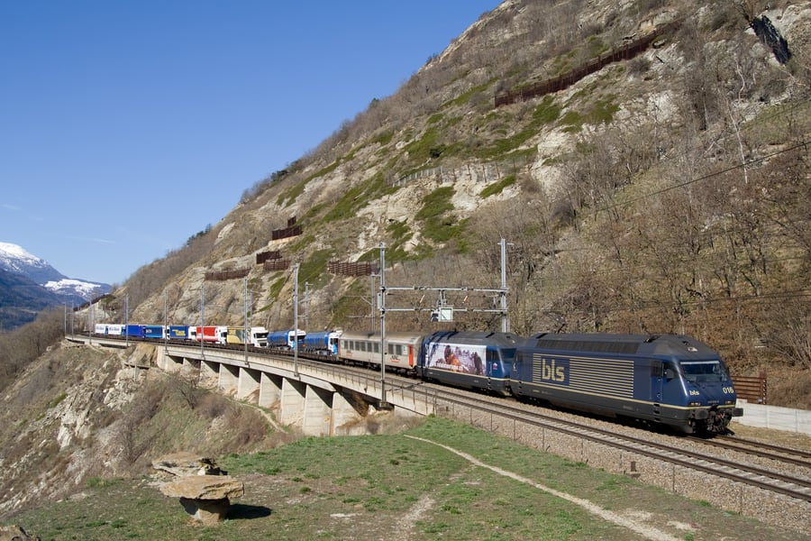
They are not alone up there. Between twenty and fifty of the freight trains on the Lötschberg axis still take the mountain route every day rather than the base tunnel, and at peak times as many as 180 car-shuttle trains a day run the fifteen minutes between Kandersteg and Goppenstein, carrying the traffic that would otherwise have used a motorway tunnel under the Rawil pass — planned in the 1970s, and never built.
Along the route
 Adrian Michael / Wikimedia Commons · CC BY-SA 3.0 · cropped
Twenty-five men, and the bend they put in the tunnel
The Lötschberg Tunnel was designed straight. On 24 July 1908 the heading broke into water-bearing glacial debris and flooded; twenty-five men at that face died. The drive was restarted on a curve passing under the Kander somewhere else entirely. This memorial stands over their graves at Kandersteg.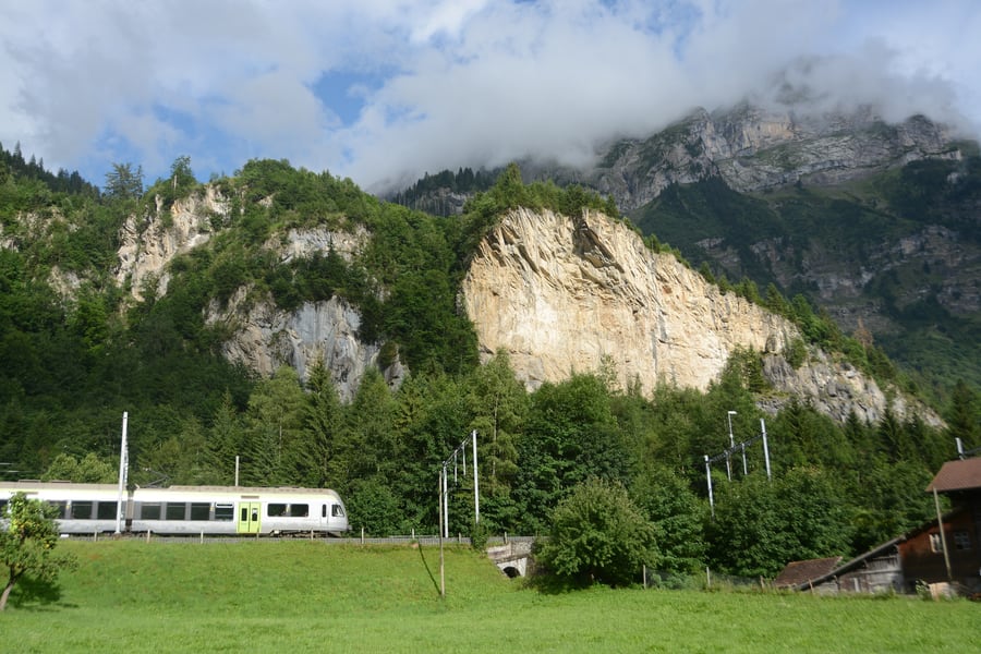 Draemmli (Roland Rytz) / Wikimedia Commons · CC BY-SA 4.0 · 2017 · cropped
The cliff above Mitholz
In December 1947 an ammunition depot inside the mountain exploded, taking off part of the mountainside and killing nine people. The scar is plainly visible from the train. About half the seven thousand tonnes stored there never went off, and the village is to be evacuated from 2030.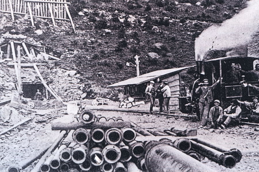 Unknown photographer, Collection Lamming / Wikimedia Commons · Public domain · c. 1906 · cropped
The railway that built the railway
Nothing could be carried up either valley by road, so two temporary 750-millimetre railways were laid first, worked by thirty-two small steam locomotives. Until the southern one reached Goppenstein in 1908, every sack of cement had gone up the Lonza gorge by mule.A bit of history
Culture & experiences along the way
 Geri340 / Wikimedia Commons · CC BY-SA 4.0 · cropped
Walking the south ramp
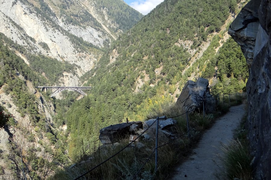
The BLS laid out a high-level path from Hohtenn down to Brig that shadows the railway for most of the way, using long stretches of the abandoned formation of the 750-millimetre construction railway, tunnels included. It is about 26 kilometres end to end, but stations cut it into sections — Hohtenn, Ausserberg, Eggerberg and Lalden are all on it — so an hour of it is as easy to take as the whole thing. The north-ramp path runs Kandersteg to Frutigen, 19 kilometres, with 34 information boards.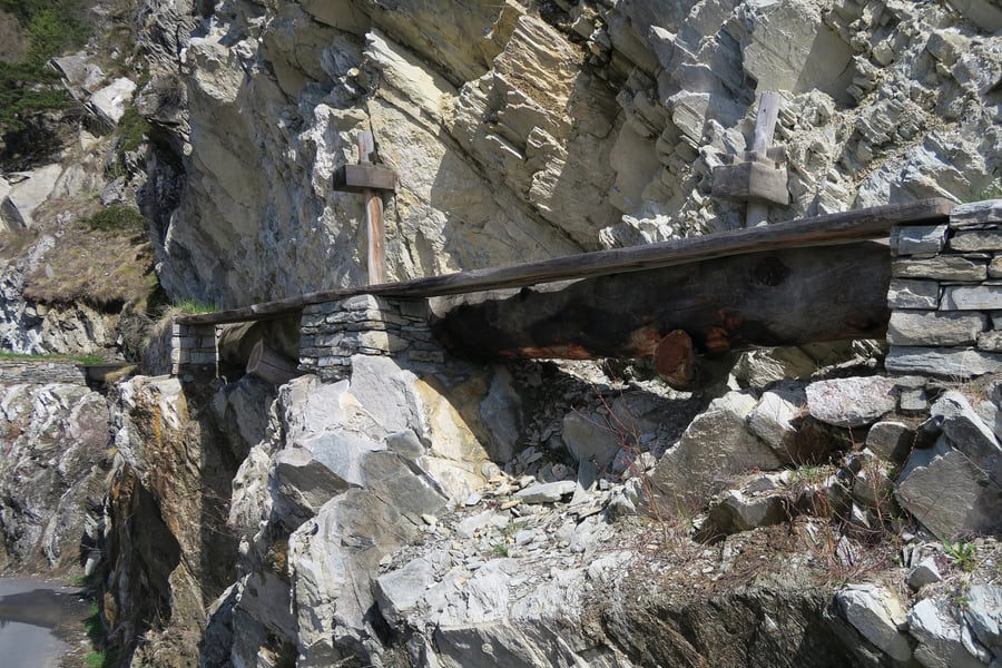 Kecko / Wikimedia Commons · CC BY 2.0 · cropped
The Suonen
The Valais is the driest canton in Switzerland, and the terraces below the south ramp have been watered for six centuries by the Suonen — open channels that carry meltwater along the mountainside, hacked into the rock or slung from it on timber where the cliff gives out. Several run within a few minutes of Ausserberg station and the paths follow them. They are worth the walk for the engineering alone, and they are what people built here before anybody could drill a fourteen-kilometre tunnel.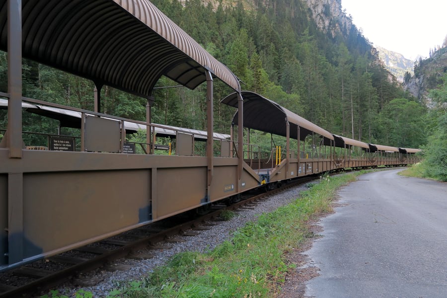 Kecko / Wikimedia Commons · CC BY 2.0 · cropped
Driving through instead
The same tunnel takes cars. You join the queue at Kandersteg, drive onto an open wagon under a hooped roof, stay in the car and get out at Goppenstein fifteen minutes later. It replaced a motorway tunnel under the Rawil pass that was planned in the 1970s and never built, and at peak times as many as 180 car trains a day go through. It is a separate ticket from the passenger train, and two francs cheaper bought online than at the ramp.Timetables
The mountain line has an hourly clock-face service with no season in it, worked by the BLS as RegioExpress RE1, Bern–Spiez–Kandersteg–Brig, with some trains continuing through the Simplon tunnel to Domodossola in Italy. The pattern below was queried against the Swiss national timetable database for a Wednesday, a Saturday and a Sunday in September 2026 and for a Wednesday in January 2027, and it came back the same on all four.
Southbound, trains leave Spiez at 12 minutes past the hour, from 06:12 to 22:12 — seventeen departures. The through workings from Bern leave at 39 minutes past, from 06:39 to 19:39; after that the train starts at Spiez. Northbound, trains leave Brig at 36 minutes past, from 06:36 to 20:36, with an earlier one at 05:11 and a later one at 22:07.
Spiez to Brig takes 1 hour 6 to 1 hour 10 minutes; Bern to Brig takes about 1 hour 40. The InterCity through the base tunnel covers the same Spiez–Brig ground in 35 minutes, which is the price of the view.
One train each way, in full
Intermediate times shift by exactly one hour from one departure to the next, so these two columns describe the whole day.
| Station | Southbound | Northbound |
|---|---|---|
| Bern | 07:39 | 12:22 |
| Münsingen | 07:51 | 12:08 |
| Thun | 08:01 | 11:59 |
| Spiez | 08:12 | 11:44 |
| Mülenen | 08:17 | 11:35 |
| Reichenbach im Kandertal | 08:19 | 11:34 |
| Frutigen | 08:25 | 11:30 |
| Kandersteg | 08:41 | 11:14 |
| Goppenstein | 08:52 | 11:02 |
| Hohtenn | 08:56 | 10:54 |
| Ausserberg | 09:04 | 10:48 |
| Eggerberg | 09:07 | 10:43 |
| Brig | 09:18 | 10:36 |
Lalden, between Eggerberg and Brig, is served by some trains and not others; the southbound departure at 07:12 from Spiez calls there at 08:10.
Weekends, and the second line
One extra pair runs at weekends only, as RE11 from Biel/Bienne: southbound it leaves Spiez at 08:32 on Saturdays and Sundays, northbound it leaves Brig at 16:01. Both take the mountain route and both appear on the same timetable page, field 330, which is the number the Lötschberg mountain line has carried since the base tunnel took over field 300.
Making sure you are on the right train
A search for Spiez to Brig returns the base-tunnel InterCitys and the mountain RegioExpress side by side, and in a list of departures they are hard to tell apart. Two things separate them reliably: the category — RE for the mountain, IC or EC for the tunnel — and the journey time, roughly seventy minutes against thirty-five. Asking for a route via Kandersteg or Goppenstein forces the mountain line, because no base-tunnel train calls at either.
Connections
Spiez is a junction with the GoldenPass line to Zweisimmen and the Lake Thun line to Interlaken, and every long-distance train between Bern and Valais passes through it. Frutigen is the last stop before the base tunnel and the first place to change between the two routes. Brig connects with the Matterhorn Gotthard Bahn for Zermatt and the Glacier Express, with the Simplon line to Milan, and with the RegioExpress down the Rhône valley to Lausanne and Geneva.
Times as published in the Swiss national timetable for the 2026 and 2027 timetable years, checked in August 2026. Operator: bls.ch (opens in a new tab).
Tickets
There is nothing special to buy. The mountain line is ordinary Swiss public transport at the ordinary national tariff, with no supplement and no reservation of any kind, and a point-to-point ticket from Spiez to Brig is valid whichever way you go — over the mountain or under it. The only thing to watch is the routing: the ticket names the route it was priced for, and a fare bought "via Lötschberg" is the mountain one. Spiez to Brig is CHF 40.00 second class, Bern to Brig CHF 56.00, each valid until five the next morning.
Supersavers start at CHF 24.20 from Spiez, tied to one departure and not refundable. Anyone in Switzerland for more than a couple of days should price a Half Fare Travelcard against these fares first — it halves every one of them. Read at sbb.ch (opens in a new tab) in August 2026.
Book your tickets
Spiez – Brig, point to point
CHF 40.00 second class · CHF 20.00 with a Half Fare Travelcard
The flexible ticket for the line itself, valid all day, with breaks of journey free.
Book Tickets (opens in a new tab, on sbb.ch)via sbb.chBern – Brig, point to point
CHF 56.00 second class · CHF 28.00 with a Half Fare Travelcard
The same fare as the base-tunnel InterCity, so the mountain costs only thirty-five more minutes.
Book Tickets (opens in a new tab, on sbb.ch)via sbb.chSupersaver, Spiez – Brig
From CHF 24.20 second class · from CHF 14.00 with a Half Fare Travelcard
Tied to one named departure, not refundable, and the cheapest way over the mountain.
Book Tickets (opens in a new tab, on sbb.ch)via sbb.chLötschberg car shuttle
CHF 28.00 Monday to Thursday · CHF 31.00 Friday to Sunday, per car
Kandersteg to Goppenstein in fifteen minutes, everyone staying in the car.
Book Tickets (opens in a new tab, on bls.ch)via bls.chRail Passes
This is one of the straightforward ones. The Lötschberg mountain line is part of the ordinary Swiss network, and every pass that covers Swiss trains covers it outright — over the mountain and under it, at no extra cost either way.
Interrail and Eurail. The 2026 Switzerland validity document lists "BLS/SBB Thun–Brig / Interlaken Ost" in the free-travel column, alongside the SBB's entire network. That corridor is this journey, and the entry does not distinguish between the mountain line and the base tunnel, so a Global Pass or a Switzerland One Country Pass carries you over the top with nothing to pay and nothing to reserve. The BLS also appears separately in the same free list for its Emmental, Simmental and Bernese lines. ⚠️ One rule catches people out: an Interrail One Country Pass cannot be used to travel into or out of the country it covers, so a Switzerland pass will not take you through the Simplon to Domodossola on the trains that continue there.
Swiss Travel Pass and Swiss Travel Pass Flex. Included in full, for three, four, six, eight or fifteen days, consecutive or freely chosen within a month. The pass is sold only to people who do not live in Switzerland or Liechtenstein and is checked against a passport or national ID. It also covers the buses at either end — the 230 up the Kander valley to Blausee, for instance — and the Lake Thun boats from Spiez.
GA Travelcard and Half Fare Travelcard. The GA includes the line. The Half Fare halves every fare on it, which on a Bern–Brig return is a saving of CHF 56.00 in a single day.
Berner Oberland Pass. Worth a look if the Bernese Oberland is the point of the trip rather than a way through it. The BLS sells it for three, four, six, eight or ten consecutive days — CHF 240.00 for three days in second class at full price, CHF 168.00 at the reduced and youth rate, with children and dogs at a flat CHF 30.00 — and describes it as free travel on almost all train and bus routes and more than twenty-five mountain railways in the Bernese Oberland, plus the boats on Lakes Thun and Brienz. ⚠️ The southern half of this journey is in Valais, not the Bernese Oberland, so the pass's area of validity is worth reading before counting on it for the crossing itself.
Is a pass worth buying for this journey alone?
No — and that is the useful answer. A full-price Spiez to Brig single is CHF 40.00 and the return is CHF 80.00, which no pass beats on a single day. The reason to hold one here is that the crossing is almost always part of something longer: Bern or Interlaken on the north side, Zermatt, the Glacier Express or Italy on the south. If your itinerary already justifies a Swiss Travel Pass or a Half Fare Travelcard, the mountain line adds nothing to the bill. If it does not, the single fare is cheaper than any pass that would cover it.
Pass conditions checked in August 2026 against the Interrail Switzerland validity document for 2026 and sbb.ch (opens in a new tab).
Places to Visit
A point-to-point ticket over the Lötschberg is valid all day and until five the next morning, and the trains are hourly, so getting off costs nothing but an hour. That matters more here than on most lines, because the stations are a long way apart in character as well as distance: Spiez is a lakeside town at 628 metres, Kandersteg is an alpine village under a wall of limestone at 1,176, and Ausserberg is a Valais wine village on a south-facing terrace with three hundred days of sun a year.
The six places below run north to south, in the order the southbound train reaches them. Two of them — Blausee and Oeschinensee — are short bus rides or walks from the railway rather than on it, and both are worth the detour. The rest are at the platform.
 Christian David / Wikimedia Commons · CC BY-SA 4.0 · cropped
Spiez
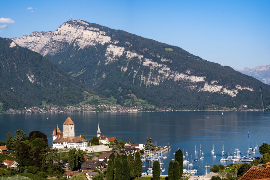
The line starts here, on a shelf above Lake Thun, and the town below the station is built round a bay with a castle on the point. The square keep went up around 1200 with walls three metres thick, and was raised in 1600 to the thirty-nine metres it stands at now; the gardens are open and the rooms are used for concerts and exhibitions. Boats leave from the harbour below it, and the GoldenPass line to the Simmental starts from the same platforms.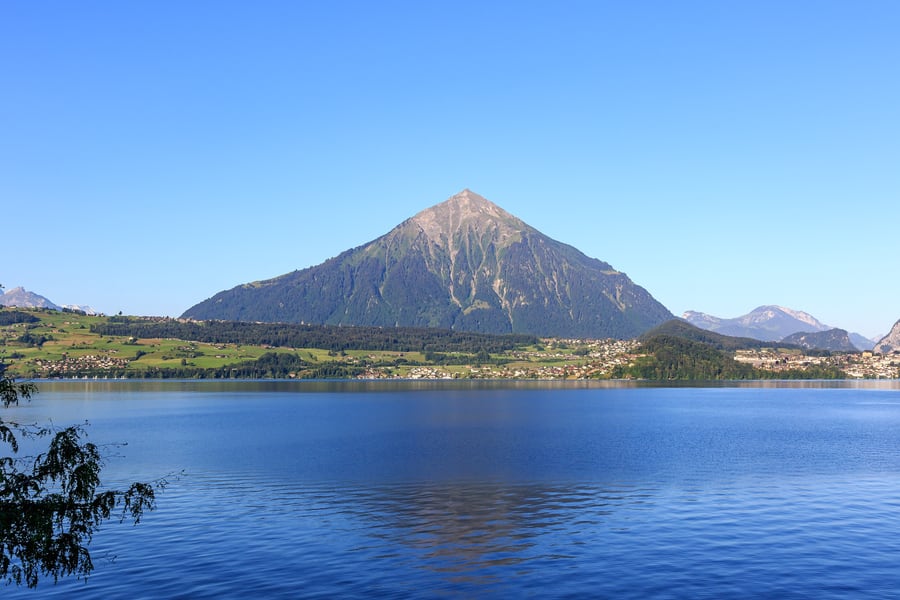 Marco Ghinolfi / Wikimedia Commons · CC0 · cropped
Mülenen and the Niesen
The second stop, and the reason to make it is in the building beside the platform: the Niesen funicular, opened in 1910, climbs 1,643 metres in two sections to a station at 2,336 metres just under the summit of the pyramid that dominates every view of Lake Thun. It runs from late April to mid-November, every half hour from eight to five. Its maintenance stairway, closed to the public but for one race a year, has 11,674 steps and is listed as the longest in the world.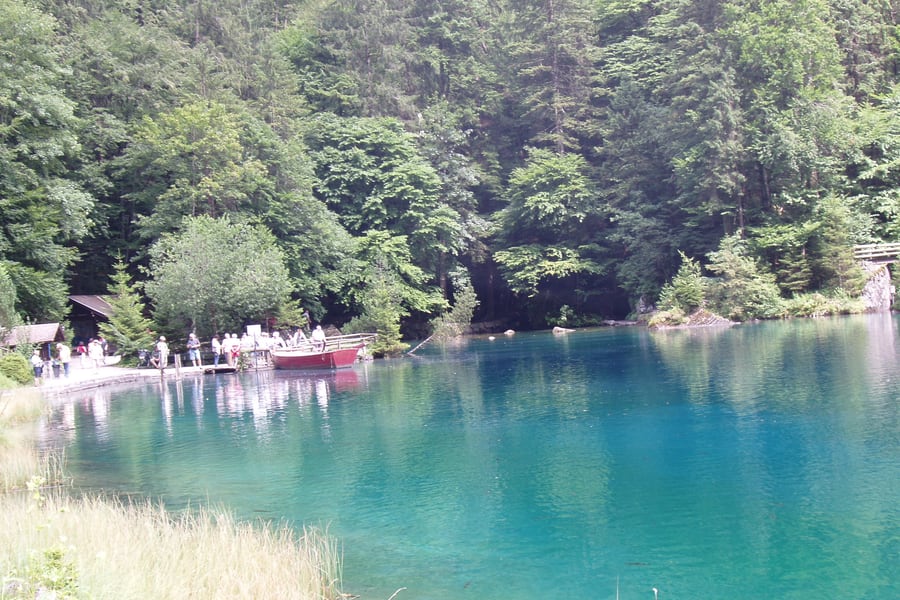 Bonnlander / Wikimedia Commons · CC BY-SA 4.0 · cropped
Blausee
A very small, very blue lake in a nature park in the Kander valley, fourteen minutes by bus from Frutigen station and open every day of the year. There is a trout farm, a restaurant, a hotel of about eighteen rooms and rowing boats on the water, and the whole thing takes an hour to walk round. The train passes above it — the old station of Blausee-Mitholz is on the line — but no longer stops, which is why the bus is the way in.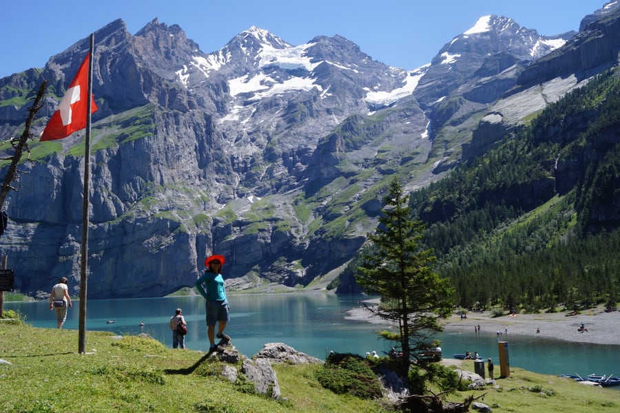 FkMohr / Wikimedia Commons · CC BY-SA 3.0 de · cropped
Kandersteg and the Oeschinensee
Kandersteg is the natural place to break the journey: an alpine village at the head of the valley, reachable from Valais only on foot before the railway came. Above it lies the Oeschinensee, dammed by a prehistoric landslide at 1,578 metres under the wall of the Blüemlisalp, part of the Swiss Alps Jungfrau-Aletsch World Heritage Site since 2007. The cable car runs daily 08:30 to 18:00 and ⚠️ a time slot must be booked online in advance, public transport ticket or not.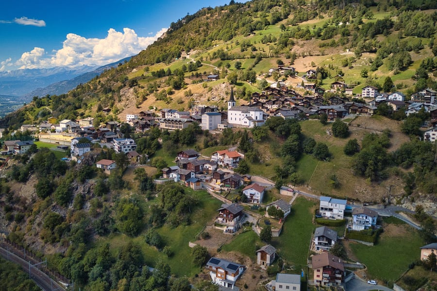 Daniel Reust / Wikimedia Commons · CC BY-SA 4.0 · cropped
Ausserberg
A Valais village on a south-facing terrace above the Rhône, with the railway running along the slope below the houses and vines above them. It is the best stop on the south ramp: the high-level path passes through it in both directions, several of the Suonen are within twenty minutes' walk, and the station hotel has a restaurant. Two of the BLS's Lötschberger units are named after this village and the next one down the line.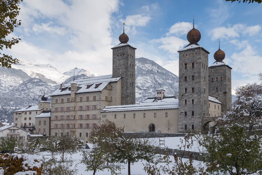 JoachimKohler-HB / Wikimedia Commons · CC BY-SA 4.0 · 2013 · cropped
Brig
The town at the foot of the Simplon, and the Stockalper Palace is a few minutes from the station. Kaspar Stockalper, who held the salt monopoly and built his own road over the pass, spent twenty years from 1658 raising an eighty-metre warehouse and residence that was the largest private building in Switzerland of its day. Its three onion-domed towers are named for the Magi, the tallest after Caspar — and after him. There are guided tours.Where to Sleep
The mountain line is short enough to ride in an hour and interesting enough to spread over two days, and the obvious way to do that is to stop at Kandersteg — the last station before the tunnel, and the one place on the route that is a resort in its own right. The four houses below are at the two ends and at two points along the way, and every one of them is within a few minutes of a platform on the line.
Prices and star ratings are not listed here because we have not checked them. What is described is what each house says about itself and what is verifiable about where it stands.
Where to stay
Belvédère Strandhotel
Above the bay at Spiez, where the line begins
Fifty-six rooms and suites in a house that has taken guests since 1908, set above Spiez bay with the lake and the Bernese Alps in front of it. There is a wellness floor with an infinity pool, whirlpool, saunas and steam rooms, a restaurant and a Captain's Bar, and the hotel's own bathing beach on Lake Thun in summer. It runs a shuttle to Spiez station, which is where the mountain line starts.
Check Availability (opens in a new tab, on belvedere-spiez.ch)via belvedere-spiez.ch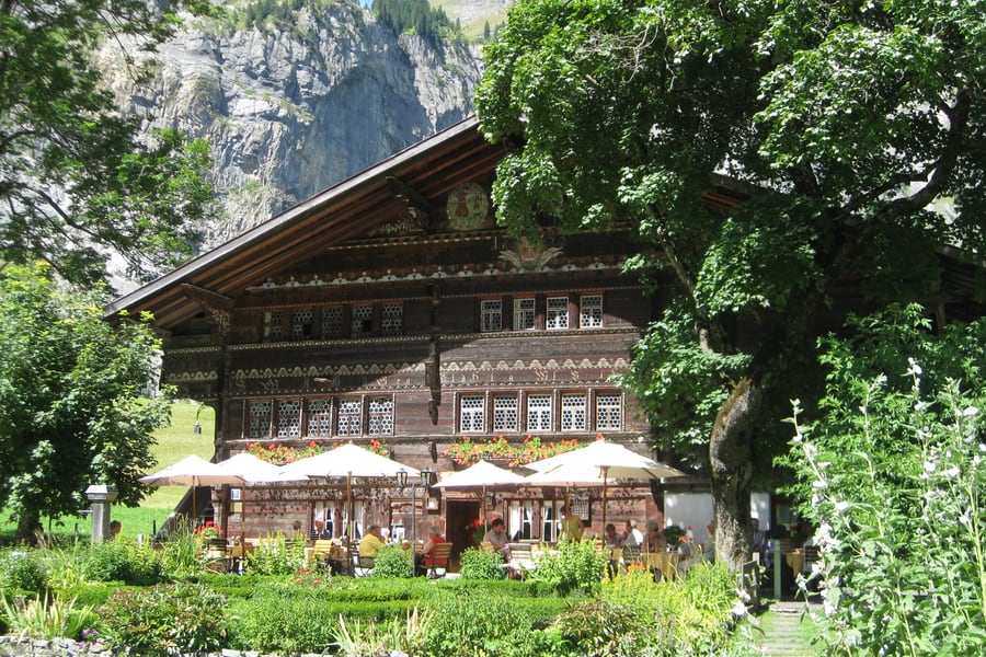 Schmock / Wikimedia Commons · CC BY-SA 3.0 · 2012 · cropped
Waldhotel Doldenhorn & Landgasthof Ruedihus
At Kandersteg, the last stop before the tunnel
Two houses run by the same family, who bought the small Pension Doldenhorn in 1976 and have been extending it ever since. The Doldenhorn has rooms from economy to suites, most with a balcony facing either the forest or the valley. Its dependance, the Ruedihus in the photograph, is a decorated timber farmhouse of about two hundred and fifty years with ten rooms and three junior suites and a kitchen of Swiss dishes.
Check Availability (opens in a new tab, on doldenhorn-ruedihus.ch)via doldenhorn-ruedihus.chHotel Bahnhof Ausserberg
On the platform, halfway down the south ramp
The station hotel at Ausserberg, at 1,008 metres on the sunny terrace above the Rhône, with the platform, the bus stop and the car park all directly outside the door. It has rooms for short stays, long stays and groups, a restaurant, and a terminal that lets guests check in at any hour. The house counts Visp at seven minutes and Brig at ten, and points out that Bern needs no change of train.
Check Availability (opens in a new tab, on hotel-bahnhof.com)via hotel-bahnhof.comHotel Ambassador
Walking distance from Brig station
A family-run house in Brig within walking distance of the station, with rooms from singles to an attic suite, all with sound-insulated windows and doors. The ground floor holds the Brasserie des Cheminots — the railwaymen's brasserie — which cooks French, and there are eight charging points for guests arriving by electric car. Brig is the junction for Zermatt, the Glacier Express and the Simplon.
Check Availability (opens in a new tab, on ambassador-brig.ch)via ambassador-brig.chQuestions or corrections
Planning this trip and stuck on something, or spotted a time, fare or detail that has changed? Send us a message about Lötschberg Mountain Line. We read every one, and we update this page when something has changed.