Ferrocarril Central Andino
David Gubler (Kabelleger) / Wikimedia Commons · CC BY-SA 3.0
- Distance346 km · Lima–Huancayo · standard gauge
- DurationA long day, each way
- Best seasonMay–Oct (the dry season)
Introduction
There are only two railways on earth that cross a mountain pass higher than four and a half thousand metres. One is the Qinghai–Tibet Railway, which we've written about, and which opened in 2006. The other has been doing it since the 1870s.
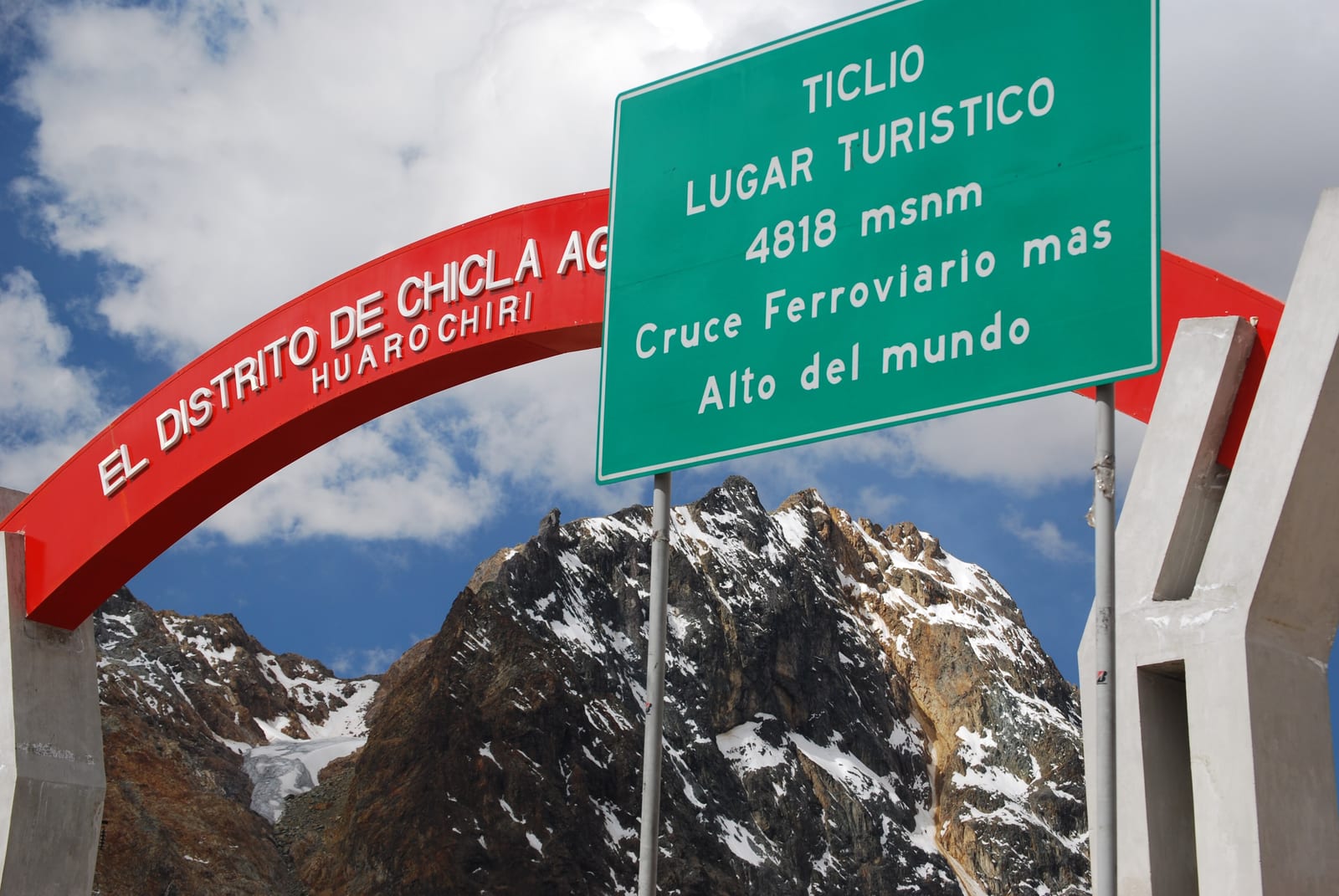
The Ferrocarril Central Andino runs 346 kilometres from Lima, on the Pacific coast, up over the Andes to Huancayo in the central highlands — and in the process it climbs from sea level to the Galera tunnel at 4,783 metres in roughly a day. Until the Tibet line opened, the sign at Ticlio, near the top, could call this the highest railway crossing in the world, and it was telling the truth. It now has to settle for second.
That it exists at all is astonishing. To haul a railway from the ocean to nearly 4,800 metres, up the wall of the western Andes, the Polish engineer Ernest Malinowski resorted to everything the nineteenth century had: sixty-nine tunnels, fifty-eight bridges, and a series of switchbacks — zigzags where the train runs into a dead end, stops, and reverses back out and up the next stretch, climbing the mountainside like a staircase. The American contractor Henry Meiggs signed to build it in 1869; the work began around 1870, and it cost a great many lives before it was done.
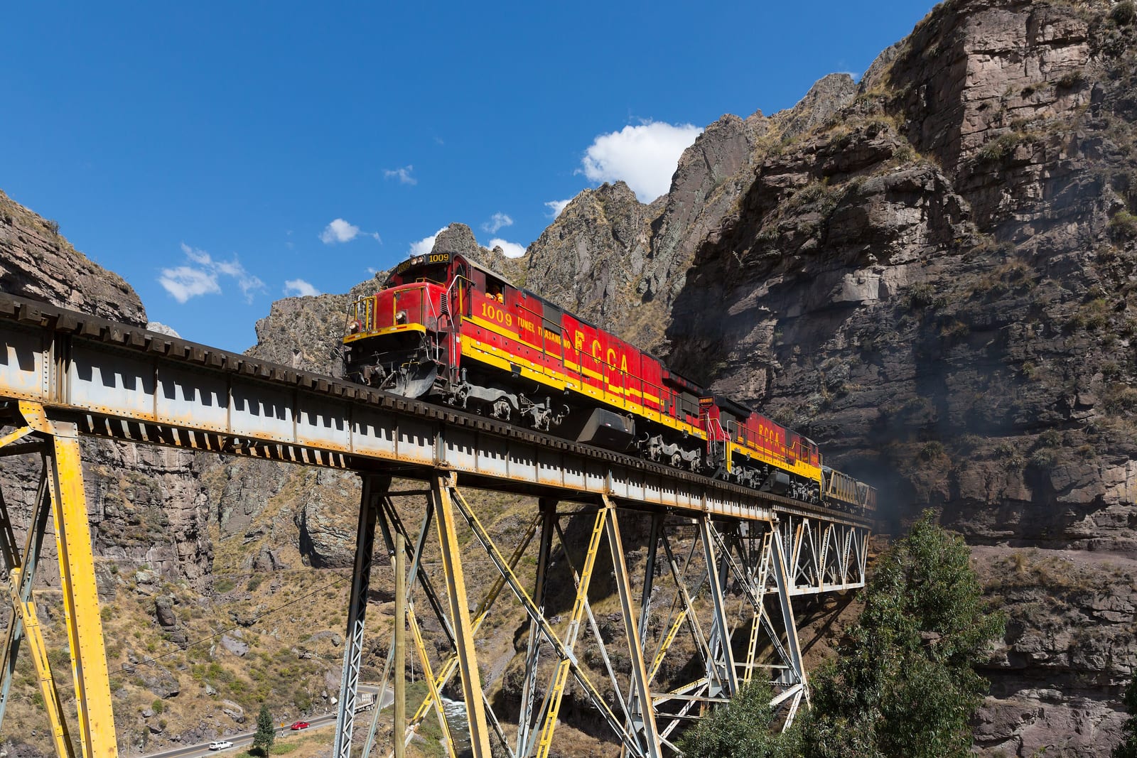
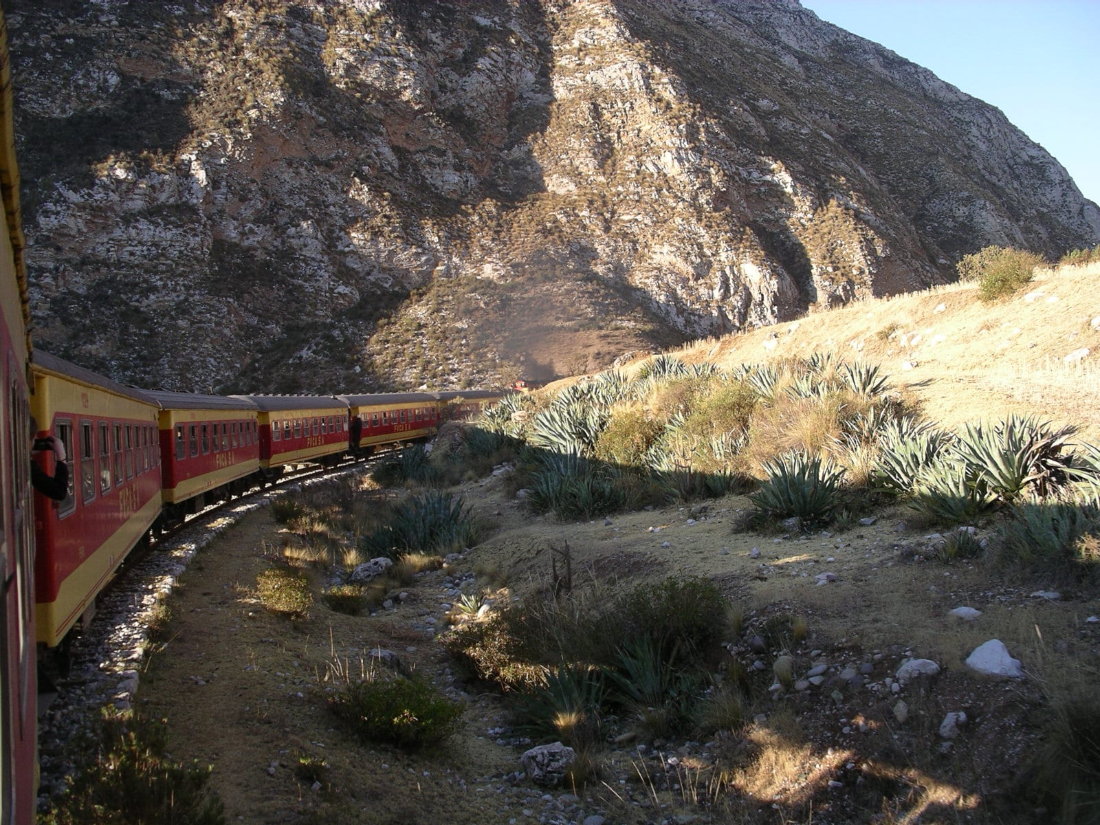
The engineering has aged into something close to unbelievable. The train crawls up sheer valleys on spindly steel trestles, doubles back on itself again and again, and bores through the rock at a height where the air holds barely half the oxygen of the coast — so the tourist trains carry oxygen for passengers, exactly as the Tibet train does.
Here is the catch, and you should know it before you get excited: there is no regular passenger service. The line is worked by freight — it was built to bring minerals down from the mountains, and it still does. Passengers ride only on occasional tourist trains that FCCA runs a handful of times a month from Lima to Huancayo. Catching one takes planning, and a bit of luck.
But if you can catch one, you get a piece of railway history that has no real equal: the second-highest line on the planet, built by hand in the age of steam, still climbing straight up the Andes on the tricks its engineer invented to make the impossible merely very difficult.
The Journey
It starts at the ocean. Lima sits on the Pacific coast at sea level, in the coastal desert, and for the first stretch out of the city the railway runs up the valley of the Rímac — dry, brown, hemmed in by bare hills — with no hint yet of what's coming.
Then the valley narrows and steepens, and the climbing begins in earnest, and does not stop.
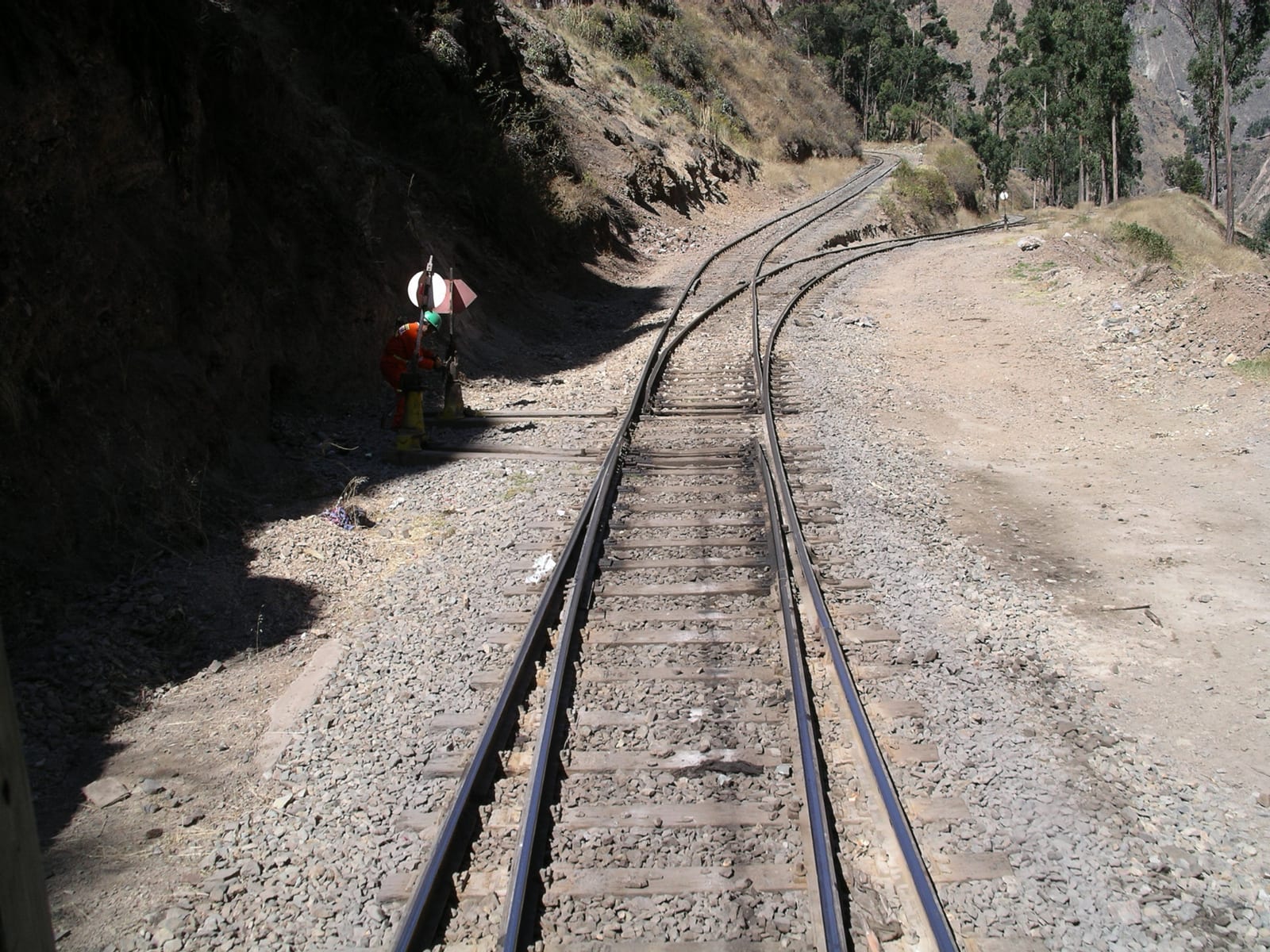
This is the part that has made railway engineers travel across the world to see it. The line clings to the side of the gorge, crosses and re-crosses the river on steel trestle bridges flung over side-canyons, and disappears into tunnel after tunnel — sixty-nine of them in all. And where the mountainside is simply too steep to climb head-on, it uses a switchback: the train runs onto a dead-end ledge, halts, and then reverses back out and up the next incline, gaining height in a zigzag it could never manage in a straight line. There are several, and watching the train work its way up them is the single best thing about the ride.
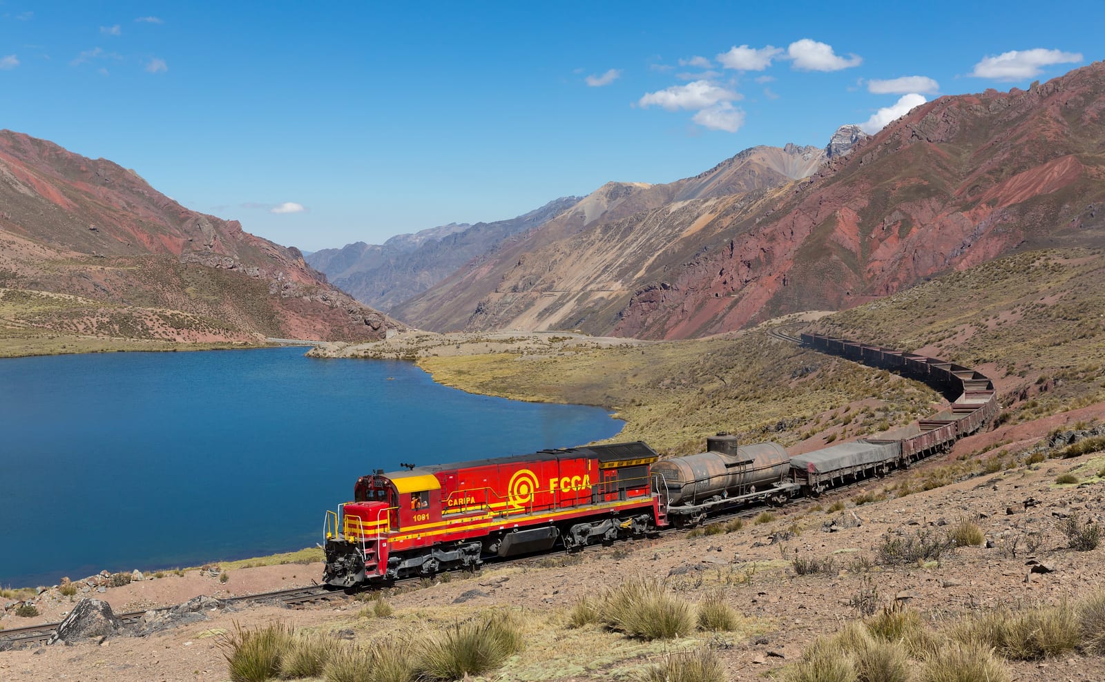
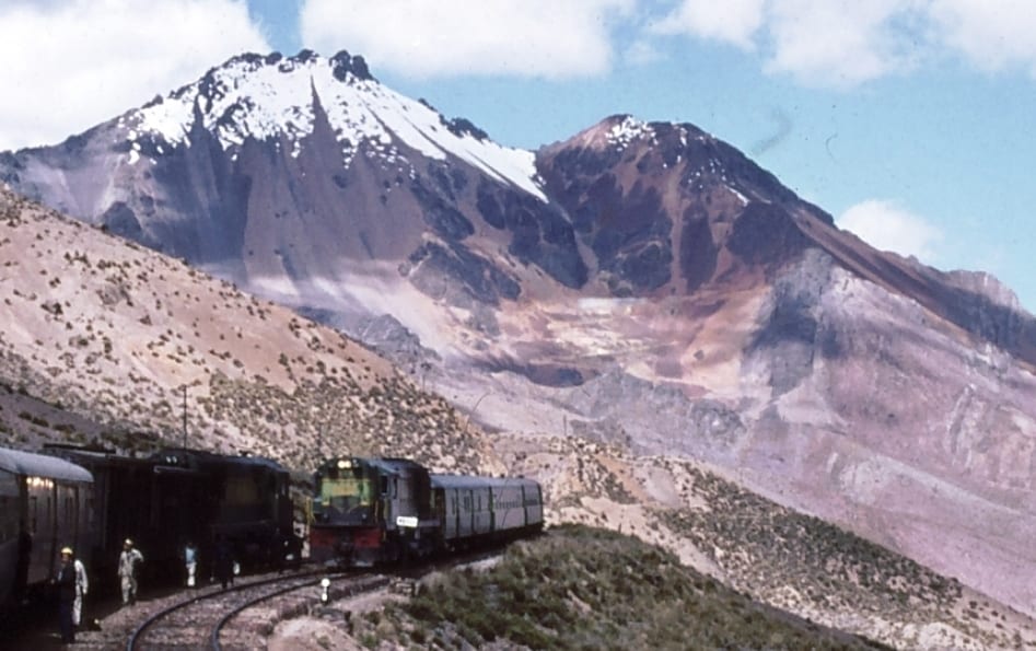
The higher you go, the harder the country gets. Green gives way to grey, trees vanish, and the world becomes rock, scree and thin cold air. Somewhere up here the train passes San Bartolomé and the great zigzags, and climbs towards Ticlio and the Galera tunnel at 4,783 metres — the roof of the line. This is genuinely hostile ground: mine workings, snow, and an altitude that makes healthy people ill, which is why the tourist trains carry oxygen and a nurse.
Over the top, the line drops onto the far side of the divide and the character changes again. The bare high puna gives way to the broad, cultivated Mantaro valley, greener and more inhabited, and the train follows it down through La Oroya — a hard mining-and-smelting town, and the junction where the branch to Cerro de Pasco heads off — and on to Huancayo, the busy commercial capital of the central highlands, at around 3,200 metres.
It is a long day, and a hard one on the body: you have gone from sea level to nearly 4,800 metres and down again in a single ride, which no other railway asks of you quite so abruptly. But you have also crossed the Andes on the second-highest railway in existence, over engineering that was audacious in the 1870s and looks scarcely believable now — and you have done it in the company of the freight trains that are the real reason the line is still here at all.
Along the route
Juan A. Malo de Molina / Wikimedia Commons · CC BY-SA 3.0Second highest on earth
Only the Qinghai–Tibet Railway goes higher. This line crosses the Andes through the Galera tunnel at 4,783 metres, and until 2006 the sign at Ticlio could honestly call it the highest railway crossing in the world.David Gubler (Kabelleger) / Wikimedia Commons · CC BY-SA 3.0Malinowski's staircase
To climb from sea level to nearly 4,800 metres in about 150 km, the Polish engineer Ernest Malinowski used 69 tunnels, 58 bridges and a series of switchbacks. It was begun in 1870 and is still one of the boldest pieces of railway engineering anywhere.Maurice Chédel / Wikimedia Commons · CC BY-SA 3.0Sea to summit in a day
The line starts at the Pacific in Lima and tops out above 4,780 metres before the day is out — one of the fastest, steepest ascents any railway makes. You feel every metre of it, and the train carries oxygen for passengers who need it.A bit of history
Culture & experiences along the way
Maurice Chédel / Wikimedia Commons · CC BY-SA 3.0The zigzags
Watch out of the window as the train reaches a switchback: it runs into a dead-end ledge, stops, and then reverses back out and up the next stretch, climbing the mountain like a staircase. There are several, and they are the cleverest thing on the line.David Gubler (Kabelleger) / Wikimedia Commons · CC BY-SA 3.0The top, at Ticlio
Near Ticlio the train passes the Galera tunnel and the highest ground on the line, around 4,800 metres — bare rock, thin cold air, mine workings and snow. It is a genuinely hostile place, and the railway simply drives straight through it.Paul Dober / Wikimedia Commons · CC BY 3.0A ride that mostly isn't there
The catch: there is no regular passenger service. The line is worked by freight, and FCCA runs occasional tourist trains — a handful of dates a month — from Lima to Huancayo. Riding it takes planning and luck, which is part of why so few people have.Timetables
This is the hardest of Peru's great trains to actually ride, because it barely carries passengers at all. Plan around the train's dates, not the other way round.
How it runs:
| Detail | What to expect |
|---|---|
| The line | Lima → Huancayo · 346 km · standard gauge |
| Summit | Galera tunnel · 4,783 m (near Ticlio) |
| The engineering | 69 tunnels · 58 bridges · several switchbacks |
| Regular passengers? | No. Freight only, plus occasional tourist trains |
| Tourist service | FCCA, a few dates a month, Lima ⇄ Huancayo |
Good to know:
- There is no daily train. The line is worked by freight; passengers ride only FCCA's tourist service, which runs on a handful of dates each month and not every month. This is the single biggest thing to plan around.
- Check the operator months ahead. Dates are limited, seasonal and can change. If riding this line is the point of your trip, fix the date first and build everything else around it.
- It's a long day each way. The tourist train leaves Desamparados station in central Lima early, around 07:00, and takes about 12 hours over the summit; most people go up one day and either stay in Huancayo or return on a later date.
- The altitude is brutal and abrupt. Sea level to 4,780 m in one ride is more than almost any other railway asks. The train carries oxygen and medical staff — use them, go easy, and don't board hungover or exhausted.
- Dry season, roughly May to October, is safest for the high line; the rains can bring landslides to a route carved into unstable mountainsides.
- Sit on the valley side where you can, and watch for the switchbacks — the moments the train reverses direction are the highlights.
Departure and season as of 2026; dates are announced only a few months ahead. Confirm with the operator — see the Tickets section below.
Tickets
Tickets come from FCCA for its tourist service, and the challenge here is availability, not price. There is no everyday passenger train: you are booking onto one of a handful of special runs, offered in classes from tourist up to a more comfortable first, a day's ride each way. Services run only a few times a month and sell to a small pool of travellers, so book as far ahead as you can, treat the date as fixed, and reconfirm before committing flights.
The real ticket, though, is your body. Nothing prepares you for sea level to 4,780 metres in a day — arrive rested, hydrated and sober, use the onboard oxygen and take altitude symptoms seriously. If you simply want a beautiful Andean train ride, the Andean Explorer is far easier to arrange. Ride this one because it is this line.
Book your tickets
FCCA tourist train
Lima – Huancayo, occasional dates
The way to ride it: FCCA's tourist service, which runs a few times a month from Lima up over the summit to Huancayo, usually with classes from tourist to first. Dates are limited and seasonal — check the operator well ahead and plan around them.
Book Tickets (opens in a new tab, on Ferrocarril Central Andino (FCCA))via Ferrocarril Central Andino (FCCA)Sort the altitude
Not a ticket, a warning
There is no gentle way up this line — it climbs from sea level to 4,780 m in a single day. The train carries oxygen, but come rested, hydrated and not hungover, and treat any serious altitude symptoms with respect. This is the hardest thing about the trip, not the booking.
Book Tickets (opens in a new tab, on Ferrocarril Central Andino (FCCA))via Ferrocarril Central Andino (FCCA)Rail Passes
No rail pass covers the Ferrocarril Central Andino. Interrail and Eurail are European schemes, and Peru is not among the 33 countries in Interrail's list of covered railway companies. FCCA sells seats on each of its few special runs directly.
Checked October 2026 against Interrail's list of railway companies (opens in a new tab).
Places to Visit
The line runs from the capital to the central highlands — a part of Peru well off the Cusco and Machu Picchu trail, and the more interesting for it. Nobody comes here by accident, and the towns are the better for that.
Two things on the route are worth knowing about without being places to visit. La Oroya, the junction where the line splits, is a mining and smelting town that spent years on lists of the most polluted places in South America — a blunt reminder that this railway was built to move metal, not tourists. And the Mantaro valley either side of Huancayo is the real reward of the far end: a broad, fertile highland valley of small towns, churches and festivals, worth two or three days rather than an afternoon. The Laguna de Paca, a few kilometres north of Jauja, is the standard outing from that end.
Plan around the altitude and around the trains. There is no regular passenger service — FCCA runs tourist departures on a handful of dates a month — so the practical shape of a trip is usually the train up, several days in the valley, and the road or a flight from Jauja back down. Going from sea level in Lima to nearly 4,800 m in a single day is a genuine physical event; take the first evening in Huancayo quietly.
 Freddiearomerop / Wikimedia Commons · CC BY-SA 4.0 · cropped
Lima's historic centre
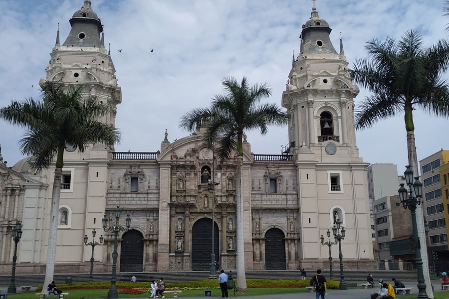
Where the line begins. Founded by Pizarro in January 1535 and the capital of Spanish South America for nearly three centuries, the old centre survived a long run of earthquakes and was made a World Heritage Site in 1988. The Plaza Mayor, the cathedral and the huge Convent of San Francisco are the core of it — though the food is what keeps most people longer.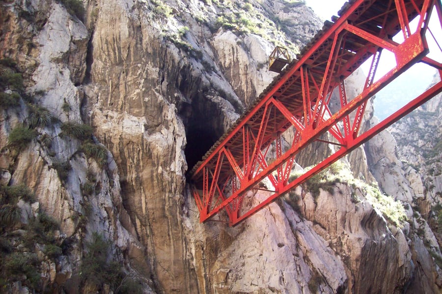 Chasquido breve / Wikimedia Commons · CC BY-SA 4.0 · cropped
The Infiernillo bridge
"Little hell" — the most photographed spot on the line, where the track bursts out of one tunnel, crosses a steel span thrown over a slot in the rock, and vanishes straight into the next. It is a fair summary of the whole Rímac gorge: a desert canyon so tight that Malinowski's engineers had to thread the railway through the rock rather than along it.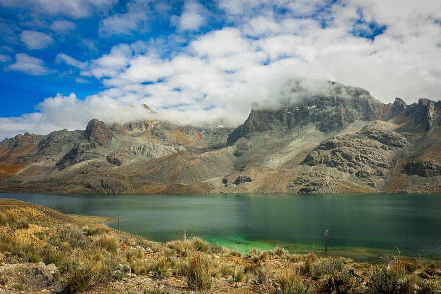 Abelchristian111 / Wikimedia Commons · CC BY-SA 4.0 · cropped
Ticlio
The roof of the line. The Carretera Central tops out here at 4,818 metres and the railway burrows through at 4,783 in the Galera tunnel — bare rock, mine workings, snow and, on the descent, lagoons the colour of jade. The sign at the crossing still claims the highest railway in the world, which was true until the Qinghai–Tibet line opened in 2006.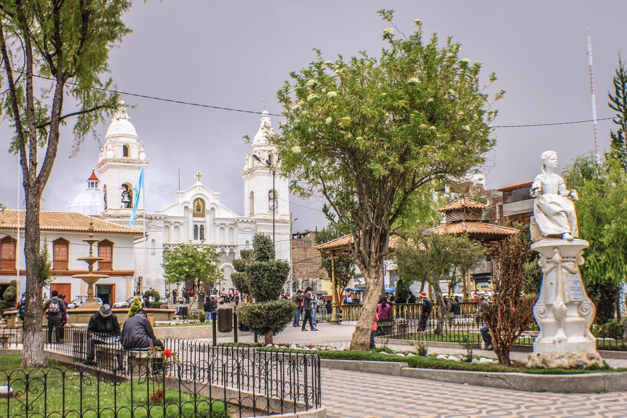 Martin Gave / Wikimedia Commons · CC BY-SA 4.0 · cropped
Jauja
Pizarro made Jauja the capital of Spanish Peru before he thought better of it and founded Lima — which is why a town of some 15,000 people in the Mantaro valley has a main square this grand. It sits at about 3,400 m, gave Spanish the phrase país de Jauja for a land of milk and honey, and has the Laguna de Paca three and a half kilometres to the north.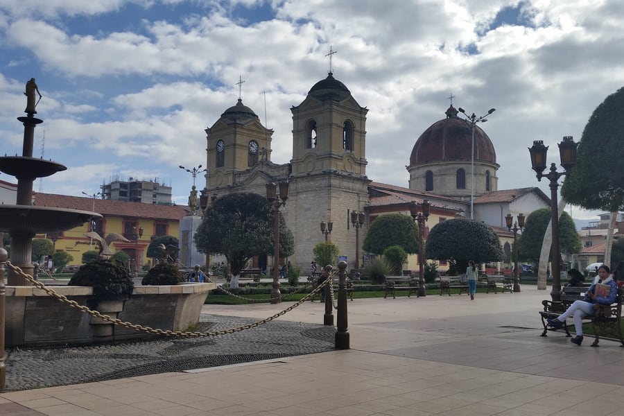 Heiner Amado Cadillo / Wikimedia Commons · CC BY-SA 3.0 · cropped
Huancayo
The capital of Junín and the fifth-largest city in Peru, at 3,256 m in the Mantaro valley, founded in 1572 on the Inca road — the old Qhapaq Ñan still runs through it as Calle Real. It is a working highland market city rather than a pretty one, and that is the appeal: the Sunday feria, the silverwork and weaving, and almost no other foreigners in sight.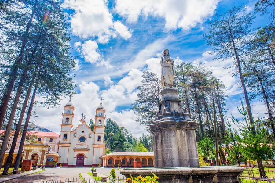 PoolPs / Wikimedia Commons · CC BY-SA 4.0 · cropped
Santa Rosa de Ocopa
Twenty-five kilometres from Huancayo, a Franciscan convent founded in 1725 as a college for missionaries — and for a century and a half the launching point for the friars who went down into the Amazon, exploring the Huallaga, the Marañón and the Ucayali. It is a museum now, and the library and the picture gallery are the reason to make the trip out.Where to Sleep
You sleep at the ends, not on the train — this is a day ride, with no sleeper. So the question is where to base yourself in Lima and Huancayo, and how to handle the altitude in between.
Lima, at sea level, is where you start, and it has beds for every budget: boutique hotels and hostels in Miraflores and Barranco near the coast, business hotels downtown, and everything between. Arrive with time in hand — you want to be rested before a day that climbs to 4,780 metres, not stepping onto the train jet-lagged.
Huancayo, at around 3,200 metres, is the highland end. It's a real working city rather than a tourist town, with straightforward hotels around the centre and a couple of nicer places on the outskirts. If you've come up on the train, spend at least a night here — both to see the Mantaro valley and because a same-day turnaround from sea level to nearly 4,800 metres and back is hard on the body.
The thing this journey demands that a hotel can't give you is acclimatisation, and the line's brutal profile makes it tricky: you gain almost 4,800 metres in a single day, faster than anywhere sensible. There's no perfect answer, but:
- Don't attempt it straight off a long-haul flight. Give yourself a couple of days in Lima first (which is at sea level, so it won't acclimatise you, but it will leave you rested).
- Break the trip at Huancayo rather than bouncing straight back — a night at 3,200 m is far kinder than a round trip in a day.
- Use the train's oxygen on the climb, drink water, and treat any real symptoms — bad headache, nausea, breathlessness at rest — as a reason to tell the onboard staff, not to tough it out.
Get the altitude right and this is one of the great railway days on earth. Get it wrong and it's a very high, very uncomfortable one.
Questions or corrections
Planning this trip and stuck on something, or spotted a time, fare or detail that has changed? Send us a message about Ferrocarril Central Andino. We read every one, and we update this page when something has changed.